
use +/- or mouse scrollwheel for magnification. click here for full-sized image.
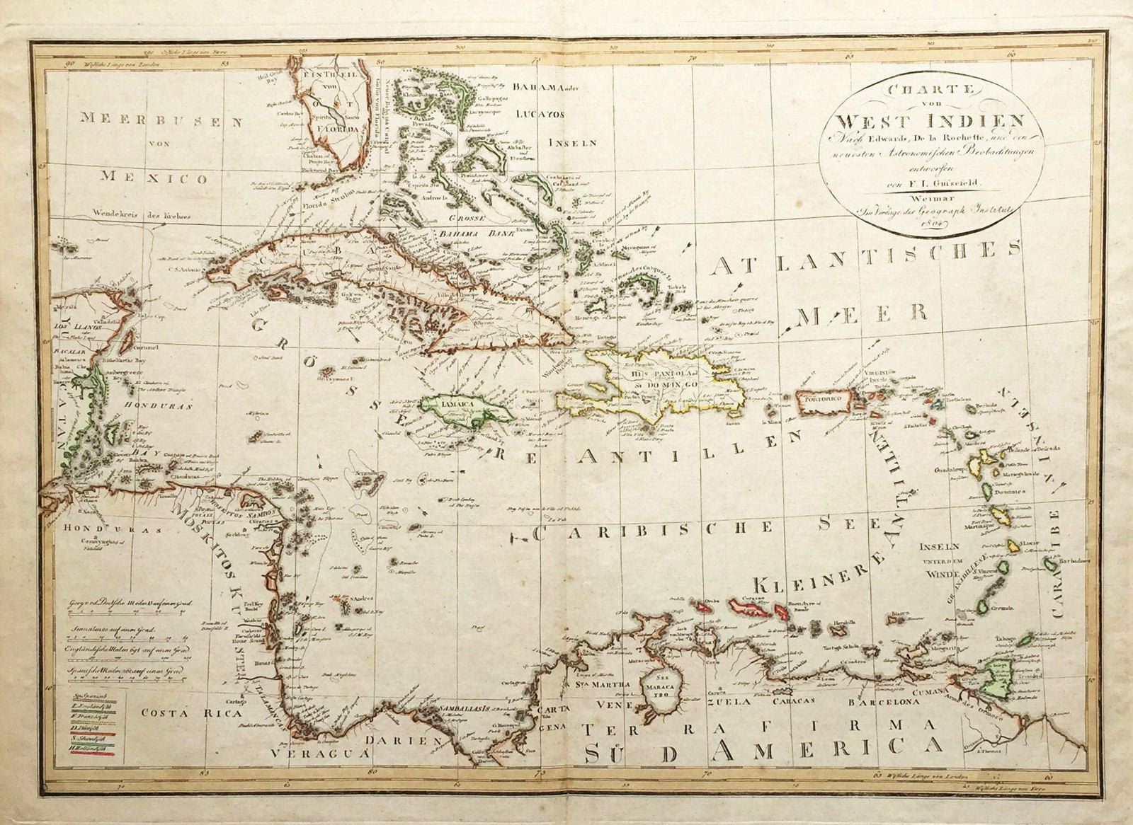
Charte von West Indien
This item has been sold. Please check our homepage for currently available maps.
A large, dramatic, and delicately colored German map of the West Indies, extending from southern Florida and the Bahamas to the coasts of the Yucatan, Central America and northern South America. Drawn from maps by Edwards, de la Rochette, and other, Gussefeld's map features excellent topographical and navigational details, many place names, an elegant title cartouche and a color key to the European colonial powers in the region. Item Number: RS2679
Cartographer: Gussefeld
Place & Date: Weimar / 1804
Size: 23 3/4" x 16 3/4"
Condition: outline color; overall age toning; minor browining and spotting mostly along edges of margins
Price: SOLD