
use +/- or mouse scrollwheel for magnification. click here for full-sized image.
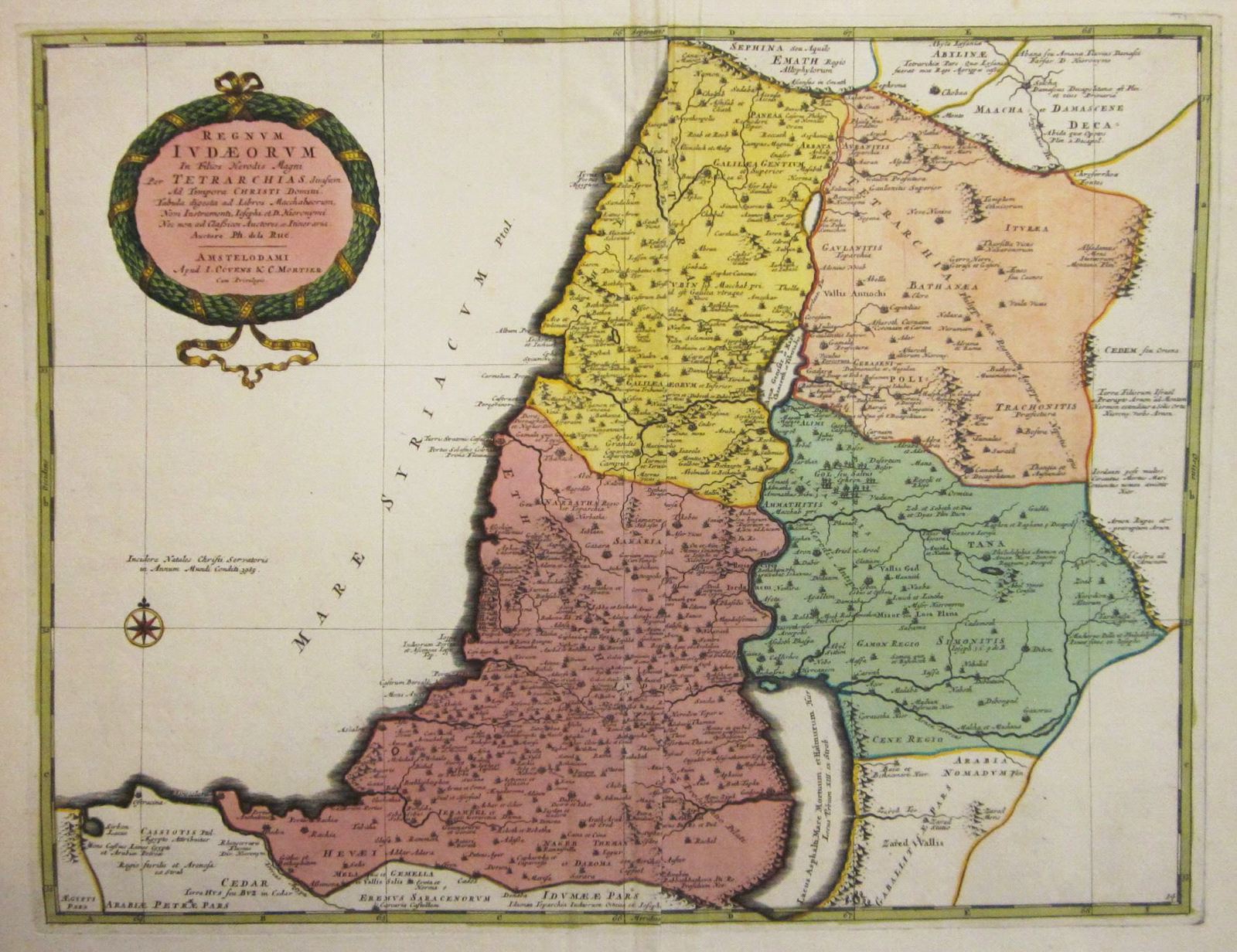
Regnum Iudeorum in Filios Herodis Magni per Tatrarchias Divisum
This item has been sold. Please check our homepage for currently available maps.
The later Covens & Mortier edition of de la Rue's scarce and fascinating map of the Holy Land, depicting the "Kingdom of the Jews divided by the sons of Herod the Great into tetrarchies at the time of Christ." Highly detailed with many place names, the map is said in the cartouche to be based on the Books of Maccabees, the works of Josephus, and others. Originally issued in de la Rue's La Terre Sainte en Six Cartes Geographiques, published in Paris by Mariette in 1651. Item Number: RS2668
Cartographer: Philippe de la Rue / Covens & Mortier
Place & Date: Amsterdam / 1730
Size: 18 1/2" x 15 1/2"
Condition: old color; overall age toning; some browning and staining along outer edges of margins; some creasing along centerfold.
Price: SOLD