
use +/- or mouse scrollwheel for magnification. click here for full-sized image.
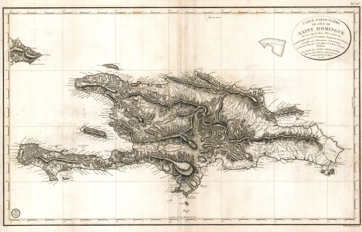
Carte Particulière de l'Isle de Saint Domingue
This item has been sold. Please check our homepage for currently available maps.
The first edition of an imposing French Depot-general de la Marine map of Hispaniola with superb topographical detail. Dated the "Year XI" (1802/1803) of the French Revolutionary calendar, the map is "based on manuscript plans by Commander Sorrel, engineer of the colonies." Item Number: RS2607
Cartographer: Dépôt général de la Marine/Sorrel
Place & Date: Paris / 1803
Size: 36" x 22"
Condition: b&w; light overall age toning; minor browning along outer edges of margins; some light creasing along centerfold
Price: SOLD