
use +/- or mouse scrollwheel for magnification. click here for full-sized image.
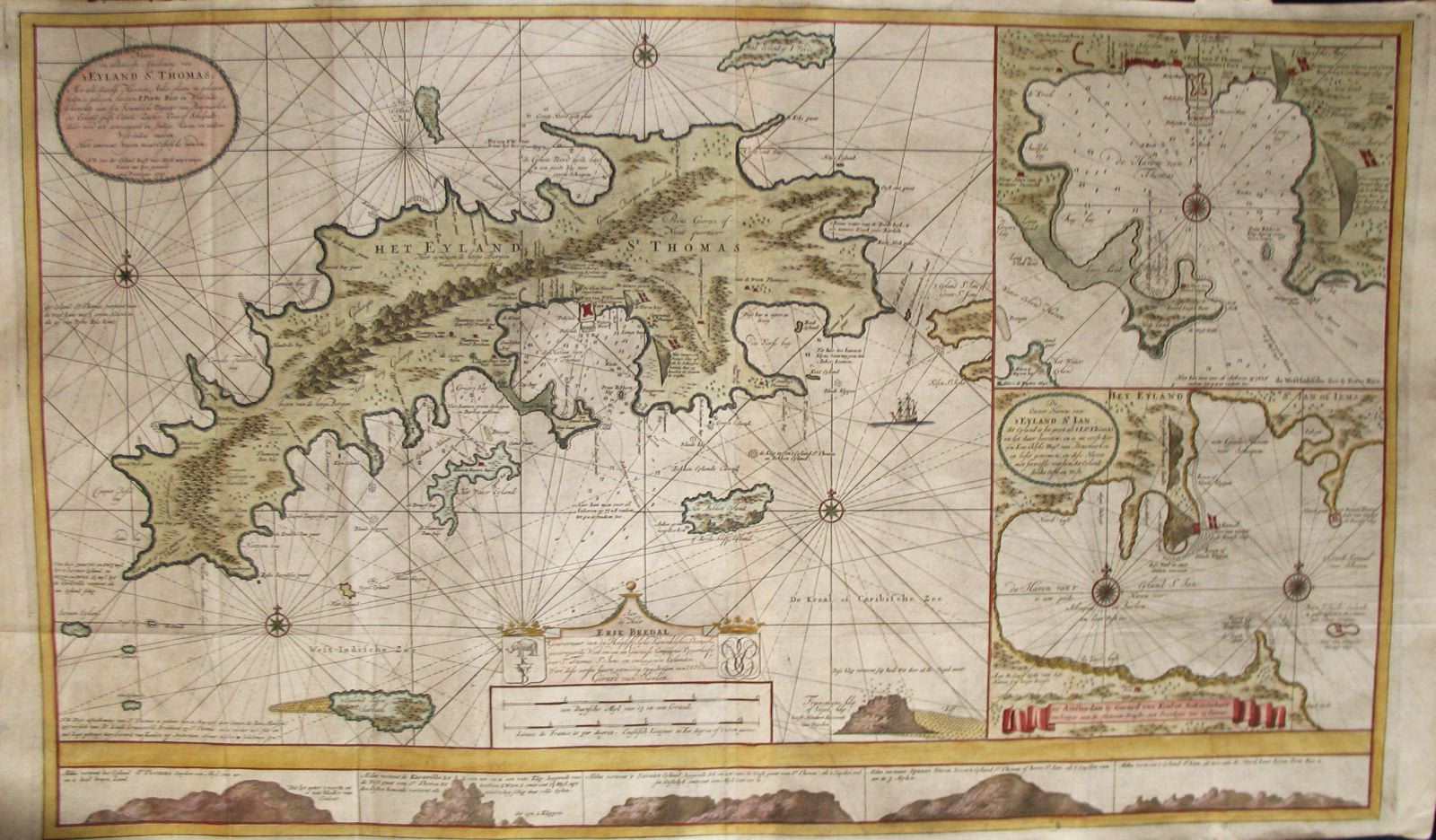
Nieuwe en Aldereerste Afteekening van 't Eyland St. Thomas
This item has been sold. Please check our homepage for currently available maps.
One of the great Virgin Islands maps, Gerard van Keulen's splendidly detailed and highly decorative sea chart of St. Thomas includes two large inset charts on the right: the upper one is of St. Thomas's main harbor and the Virgin Islands capital, Charlotte Amalie; the lower chart is of neighboring St. John's Cruz Bay. Along the bottom of the chart are coastal profiles; the cartouche and coats of arms above the mileage scale dedicates the chart to Erik Bredal, governor of the Danish West India Company. Item Number: RS2535
Cartographer: van Keulen
Place & Date: Amsterdam / 1719/1780
Size: 39" x 21"
Condition:
Price: SOLD