
use +/- or mouse scrollwheel for magnification. click here for full-sized image.
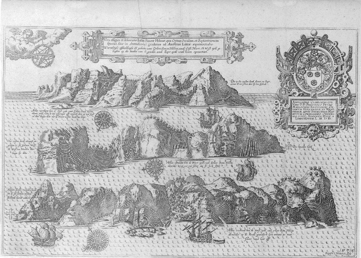
Vera effigies et delineatio Insulae Sanctae Helenae
This item has been sold. Please check our homepage for currently available maps.
The second St. Helena plate from Linschoten's Itinerario features three rugged coastal profiles of, from top to bottom, the east, north, and west sides of the South Atlantic island, which was an important resupply point for early Portuguese fleets and the site of Napoleon's final exile. Surrounding the island views are decorative windroses and ships at sea, two magnificent strapwork cartouches (title and dedicatory), and in the upper left corner, an angel holding an armillary sphere. Item Number: RS2526
Cartographer: Linschoten
Place & Date: Amsterdam / 1596ff
Size: 18 3/4" x 12 1/4"
Condition: b&w; folds as issued and some creasing; left, right and bottom margins trimmed close.
Price: SOLD