
use +/- or mouse scrollwheel for magnification. click here for full-sized image.
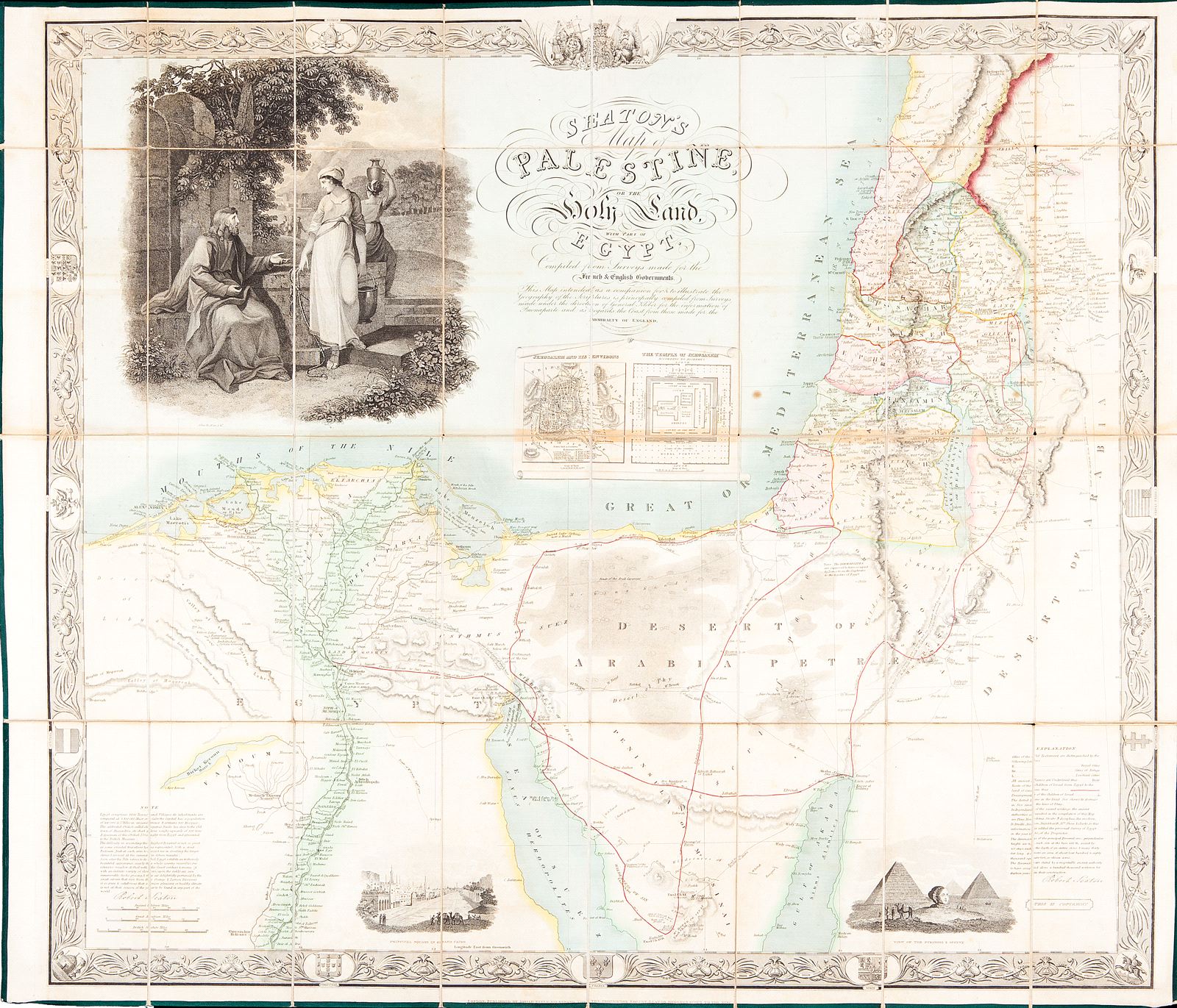
Seaton's Map of Palestine, or the Holy Land, with part of Egypt. Compiled from Surveys made for the French & English Governments...
This item has been sold. Please check our homepage for currently available maps.
Neele's wonderfully detailed and decorative folding map of the Holy Land and part of Egypt “intended as a companion for & to illustrate [Seaton's] geography of the scriptures . . compiled from the surveys made under the direction of General Kleber for the infomation of Buonaparte and as regards the coast from those made for the Admiralty of England." Segmented, laid on linen, and folded and bound into hard covers, the map includes a large illustration of Christ and the Samaritan woman at the well, plans of Jerusalem and the Temple, a view of Cairo, and a fanciful rendering of the pyramids and the Sphinx. The Holy Land is divided into the territories of the Twelve Tribes. The decorative border features the coats of arms/shields of world powers, including the United States. Laor 712. Item Number: RS2475
Cartographer: Neele / Seaton
Place & Date: London / 1835
Size: 36 1/2" x 32"
Condition: full color; overall age toning; some spots and browning along the horizontal centerfold; a few splits in linen backing in a few fold corners; covers worn and scuffed but intact.
Price: SOLD