
use +/- or mouse scrollwheel for magnification. click here for full-sized image.
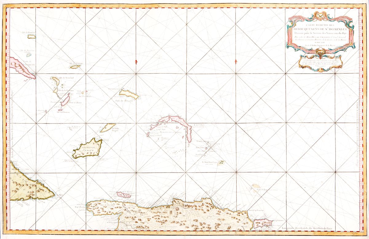
Carte reduite des Débouquemens de St. Domingue
This item has been sold. Please check our homepage for currently available maps.
Bellin's spectacular, large scale map of northern Hispaniola (present day Haiti and the Dominican Republic), the Turks and Caicos islands, and the Lower Bahamas. Its meticulous topographical and nautical detail makes this one of the major 18th century charts of the Turks and Caicos, the Lower Bahamas, and the "debouquemens" (channels, open seaways) north of Hispaniola. Item Number: RS2442
Cartographer: Bellin / Depot de la Marine
Place & Date: Paris / 1765 / 1768
Size: 35" x 23"
Condition: beautifully colored; right and left margins expertly restored
Price: SOLD