
use +/- or mouse scrollwheel for magnification. click here for full-sized image.
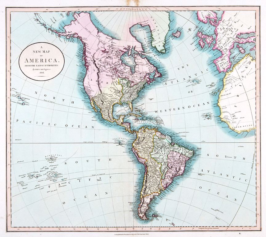
A New Map of America
This item has been sold. Please check our homepage for currently available maps.
The great Americas map from Cary's New Universal Atlas extends from western Europe and northwestern Africa to Hawaii (Sandwich Islands) and the Marquesas and Society Islands in the South Pacific. Like the other maps from this influential atlas, the Western Hemisphere map abounds in place names and topographical details, some of them imaginary (like Aurora Island, shown east of the Falklands). Item Number: RS2433
Cartographer: John Cary
Place & Date: London / 1806
Size: 20 5/8" x 18 1/4"
Condition: original color; light overall age toning; browning on upper margin around centerfold
Price: SOLD