
use +/- or mouse scrollwheel for magnification. click here for full-sized image.
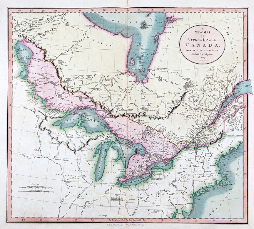
A New Map of Upper & Lower Canada
This item has been sold. Please check our homepage for currently available maps.
The great Canada map from Cary's New Universal Atlas extends from the mouth of the St. Lawrence to Lake Winnipeg, with a focus on the Great Lakes. Like the other maps in this influential atlas, this beautifully colored map is rich in topographical and navigational details. Item Number: RS2430
Cartographer: John Cary
Place & Date: London / 1807
Size: 20 1/4" x 18"
Condition: original color; light overall age toning; a repaired nick in the edge of the upper margin.
Price: SOLD