
use +/- or mouse scrollwheel for magnification. click here for full-sized image.
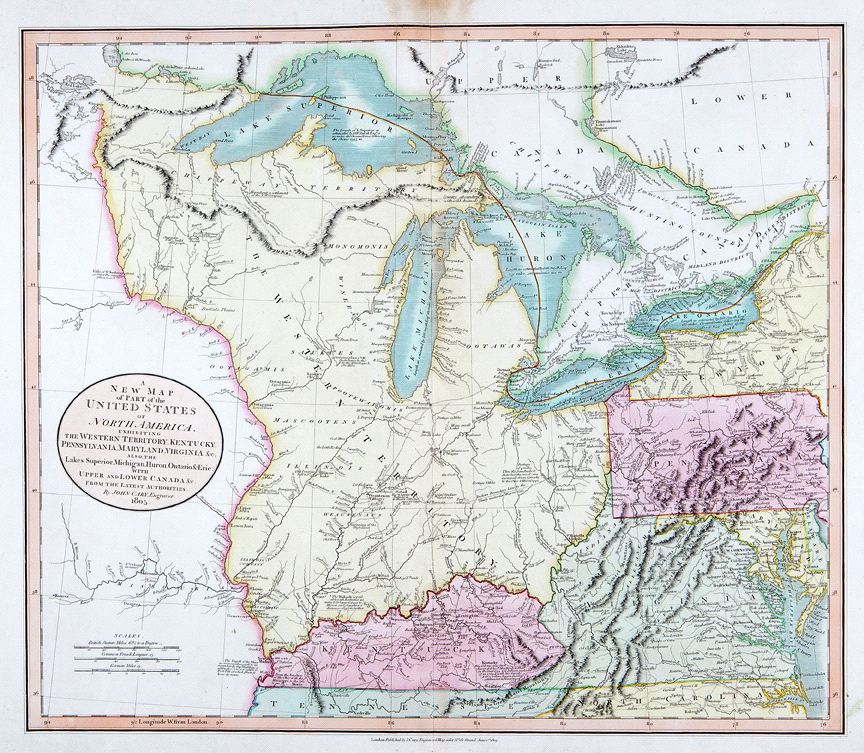
A New Map of Part of the United States of North America, exhibiting the Western Territory, Kentucky, Pennsylvania, Maryland, Virginia &c., also the lakes Superior, Michigan, Huron, Ontario & Erie; with Upper and Lower Canada &c.
This item has been sold. Please check our homepage for currently available maps.
The scarce first state of Cary's superbly detailed map of the U.S. Western Territory and Great Lakes region, from his New Universal Atlas. The beautifully colored and preserved map extends from New York, Pennsylvania and the Delmarva peninsula to the Louisiana Territory and is rich in topographical and navigational details as well as information about the region's Indian populations. Item Number: RS2427
Cartographer: John Cary
Place & Date: London / 1805
Size: 20 1/8" x 18"
Condition: original color; overall age toning; some browning on the upper margin along the centerfold not affecting the printed area.
Price: SOLD