
use +/- or mouse scrollwheel for magnification. click here for full-sized image.
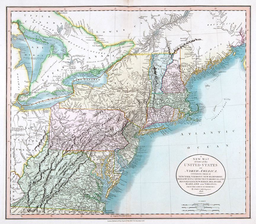
A New Map of Part of the United States of America Containing those of New York, Vermont, New Hampshire, Massachusets, Connecticut, Rhode Island, Pennsylvania, New Jersey, Delaware, Maryland and Virginia.
This item has been sold. Please check our homepage for currently available maps.
The highly detailed map of the northeastern United States from the district of Maine to Virginia and including part of the Western Territory and Lakes Ontario, Erie, and Huron, from Cary's New Universal Atlas. The beautifully colored map is rich in topographical and navigational details as well as information about the region's Indian populations. Item Number: RS2426
Cartographer: John Cary
Place & Date: London / 1806
Size: 27 3/4" x 18"
Condition: original color; overall age toning; some browning on the upper margin along the centerfold not affecting the printed area.
Price: SOLD