
use +/- or mouse scrollwheel for magnification. click here for full-sized image.
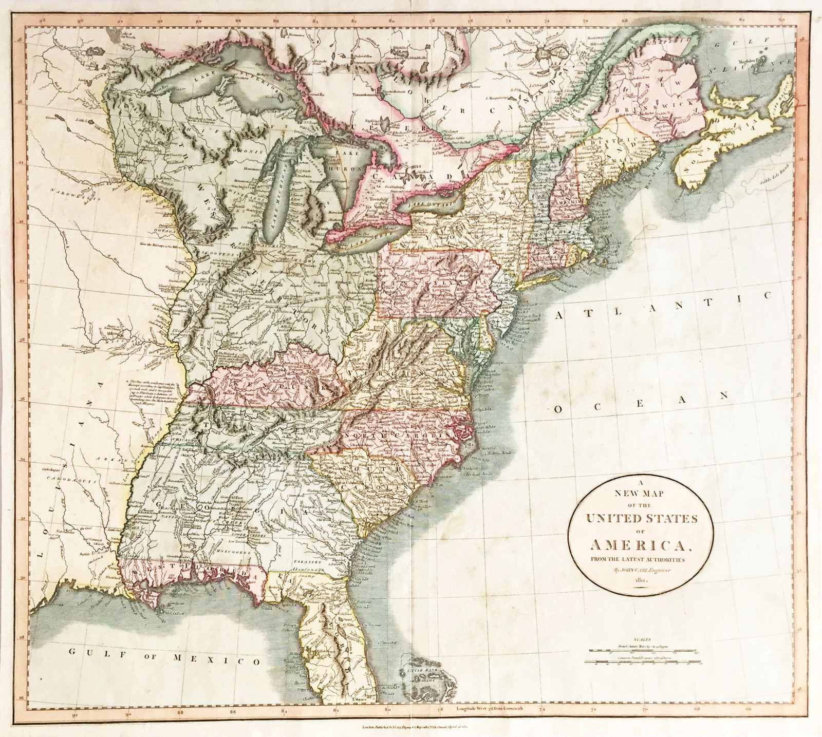
A New Map of the United States of America
This item has been sold. Please check our homepage for currently available maps.
The highly detailed map of the United States east of the Mississippi River from Cary's New Universal Atlas. Encompassing part of the Louisiana Territory and Upper and Lower Canada, the map is rich in details about Indian populations and settlements and forts in the Western Territory. Item Number: RS2425
Cartographer: John Cary
Place & Date: London / 1811
Size: 20" x 17 3/4"
Condition: original color; overall age toning and spotting
Price: SOLD