
use +/- or mouse scrollwheel for magnification. click here for full-sized image.
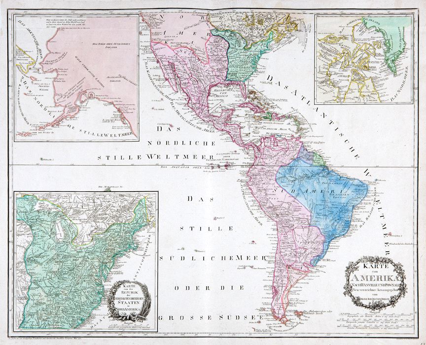
Karte von Amerika Nach d'Anville und Pownall/Karte von der Republik der Vereinigten Dreyzehen Staaten in Nord Amerika
This item has been sold. Please check our homepage for currently available maps.
A highly informative map of the Western Hemisphere, made even more so by three inset maps. The United States inset, with its own decorative title cartouche, focuses on the fledgling nation of thirteen states and includes a huge number of place names and notes on topography and native tribes. The two other inset maps depict the northeastern and northwestern extremes of North America. The northwestern inset shows Alaska as a thin promontory marked "Alaschka" and includes references to discoveries by Dixon in 1787, the Spanish in 1775, and Wallis in 1730. The northeastern inset shows Greeland as part of the North American mainlain and includes speculation on the possible location of a Northwest Passage. Item Number: RS2396
Cartographer: von Reilly
Place & Date: Vienna / 1795
Size: 30" x 23"
Condition: wash color; light overall age toning and minor spotting. A repaired tear in the upper margin extends slightly into the border.
Price: SOLD