
use +/- or mouse scrollwheel for magnification. click here for full-sized image.
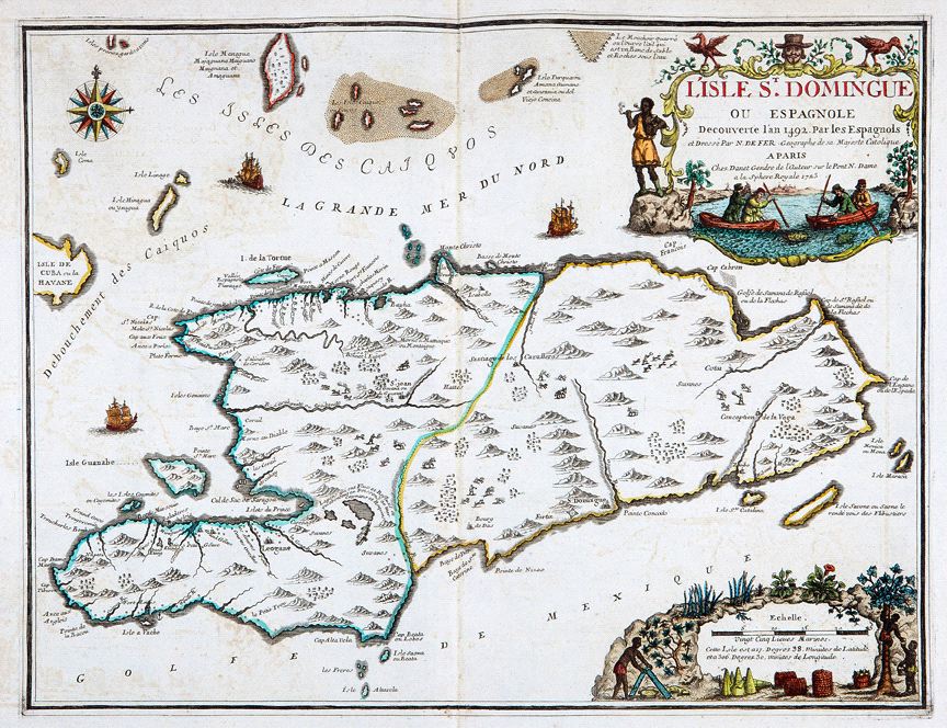
L'Isle St. Domingue ou Espagnole Decouverte l'An 1492. Par les Espagnols
This item has been sold. Please check our homepage for currently available maps.
DeFer's oddly configured, but striking St. Domingue map shows the major Spanish colonial towns and French settlements on the island, hunting scenes, and sailing ships. It has two extraordinary cartouches. The title cartouche features a tortoise hunt; the mileage scale cartouche shows papaya, sugar cane, tobacco, and yucca, and island natives picking papaya and processing yucca. Item Number: RS2395
Cartographer: de Fer / Danet
Place & Date: Paris / 1723
Size: 23" x 17"
Condition: a beautifully colored exemplar; light overall age, some overprinting and a few marginal stains
Price: SOLD