
use +/- or mouse scrollwheel for magnification. click here for full-sized image.
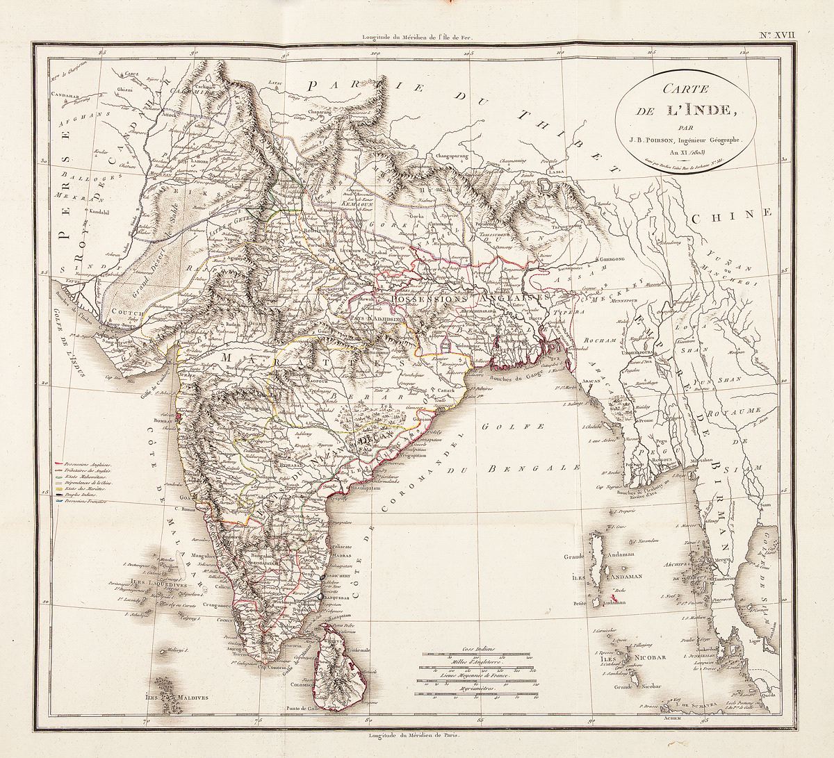
Carte de l'Inde
This item has been sold. Please check our homepage for currently available maps.
A beautifully colored and preserved exemplar of Poirson's wonderfully detailed map of India, encompassing parts of Iran (Perse), Afghanistan (Empire de Candahar), Tibet, China, and Indochina (Empire de Birman). Includes a color key to the region's colonial and local powers (English, French, Muslim, Chinese dependencies, and Indian princely states). From the atlas volume of the Statistique générale et particulière de la France et de ses colonies, publlished by F. Buisson. Item Number: RS2385
Cartographer: Poirson//Tardieu
Place & Date: Paris / 1803/1804
Size: 16 3/8" x 15 1/2"
Condition: folding map; outline color; very light overall age toning
Price: SOLD