
use +/- or mouse scrollwheel for magnification. click here for full-sized image.
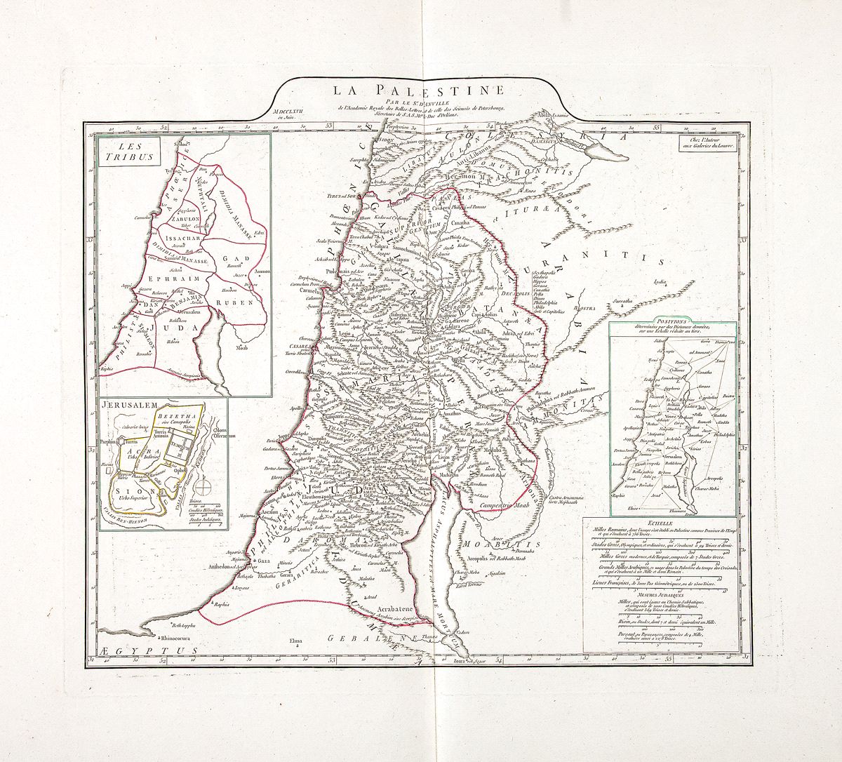
La Palestine
This item has been sold. Please check our homepage for currently available maps.
d'Anville's highly detailed and informative map of the ancient Holy Land, with three inset maps: the territories of the 12 tribes of Israel, a plan of Jerusalem, and distances between Holy Land sites according to Roman, Greek, Arabic and French scales. The mileage scales below this last inset also includes scales of "Judaic Measures." Item Number: RS2378
Cartographer: J.B.B. d'Anville
Place & Date: Paris / 1767
Size: 17" x 15"
Condition: outline color; a beautifully preserved and very wide-margined exemplar
Price: SOLD