
use +/- or mouse scrollwheel for magnification. click here for full-sized image.
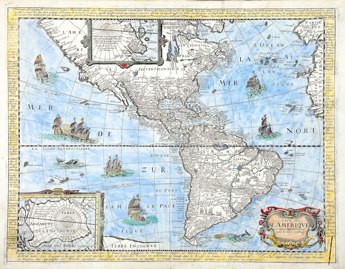
Carte de L'Ameriqve Corrigeé, et augmenteé, dessus toutes les aultres cy deuant
This item has been sold. Please check our homepage for currently available maps.
The first state (of 2) of Berey's rare, separately published Western Hemisphere map, derived from the Bertius/Hondius 1624 map. Includes two polar inset maps and a surround of French text on the hemisphere's history and colonization. Item Number: RS2371
Cartographer: N. Berey
Place & Date: Paris / 1658
Size: 20" x 15 5/8"
Condition: wash color; marginal spotting, small tear to lower centerfold, lower right corner reinforced,
Price: SOLD