
use +/- or mouse scrollwheel for magnification. click here for full-sized image.
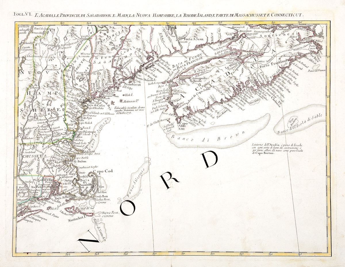
L'Acadia, le Provincie di Sagadahook e Main, la Nuova Hampshire, la Rhode Island, e parte di Massachusset e Connceticut
This item has been sold. Please check our homepage for currently available maps.
The highly detailed eastern New England map from Zatta's 1778 12-sheet version of Mitchell's landmark map of North America, encompassing the twin forks of Long Island, Rhode Island, parts of Massachusetts, Connecticut, New Hampshire, Maine, and Nova Scotia. Includes many place names, topographical details, and tribal notes. Item Number: RS2367
Cartographer: Zatta
Place & Date: Venice / 1778
Size: 16 3/4" x 12 1/2"
Condition: outline color; light overall age toning; minor spotting
Price: SOLD