
use +/- or mouse scrollwheel for magnification. click here for full-sized image.
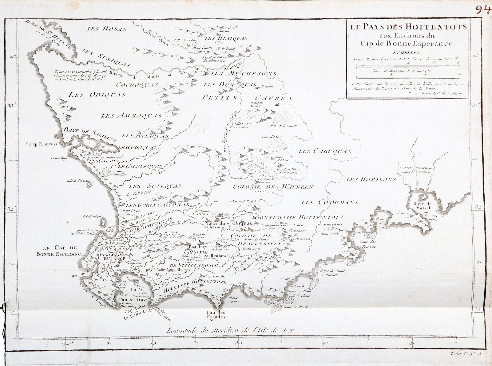
Le Pays des Hottentots aux Environs du Cap de Bonne Espérance.
This item has been sold. Please check our homepage for currently available maps.
Bellin's map of southern Africa ("Hottentot country"), from the atlas of Prevost d'Exiles' influential collection of travel narratives, Histoire Generale des Voyages. The map extends from Saint Helena Bay in the Atlantic to Mussel Bay in the Indian Ocean, with Robben Island, the Cape of Good Hope, and False Bay in between. Includes many Dutch and African place names and good topographical details. Item Number: RS2332
Cartographer: Bellin
Place & Date: Paris / 1747/1760
Size: 13 5/8" x 9 5/8"
Condition: b&w; overall age toning; some spotting; folded and margins extended with contemporary paper to fit the size of the atlas volume; lower left margin trimmed close
Price: SOLD