
use +/- or mouse scrollwheel for magnification. click here for full-sized image.
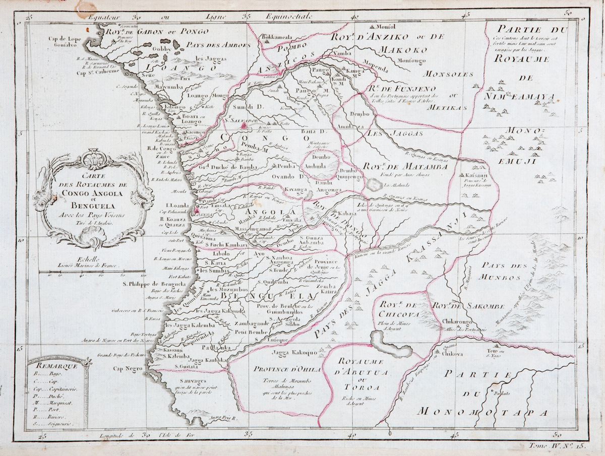
Carte des Royaumes de Congo Angola et Benguela
This item has been sold. Please check our homepage for currently available maps.
Bellin's highly detailed map of southwest Africa, including the kingdoms of Gabon, Congo, Angola, Benguela (part of present day Angola), Anziko (Dem. Rep. of the Congo), Nimeamaya, Abutua ("rich in silver mines"), Monmotapa (Zimbabwe), and others, from the atlas of Prevost d'Exiles' influential collection of travel narratives, Histoire Generale des Voyages. The map includes many place names, an elegant title cartouche, and a key to geographic features and political divisions. Item Number: RS2331
Cartographer: Bellin
Place & Date: Paris / 1747/1760
Size: 12 1/4" x 9 1/4"
Condition: b&w, with kingdom boundaries highlighed in red; overall age toning; some spotting; folded and margins extended with contemporary paper to fit the size of the atlas volume
Price: SOLD