
use +/- or mouse scrollwheel for magnification. click here for full-sized image.
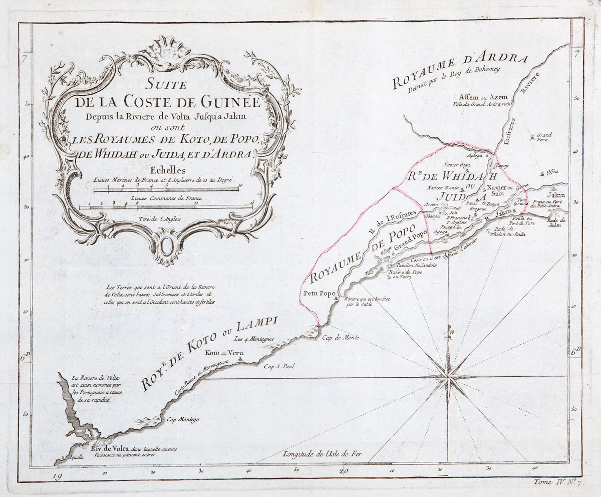
Suite de la Coste de Guinee depuis la Riviere de Volta jusqu'a Jakin ou sont les royaumes de Koto, de Popo, de Whidah ou Juida, et d'Ardra
This item has been sold. Please check our homepage for currently available maps.
Bellin's beautifully detailed and engraved map of the stretch of the Guinea coast, east of the Volta River (Ghana) encompassing the Kingdoms of Koto, Popo, Whidah, and Ardra (the latter "destroyed by the King of Dahomey"), a.k.a. the Slave Coast, from the atlas of Prevost d'Exiles' influential collection of travel narratives, Histoire Generale des Voyages. Item Number: RS2329
Cartographer: Bellin
Place & Date: Paris / 1747/1760
Size: 10 5/8" x 8"
Condition: b&w, with boundaries of kingdoms highlighted in red; light overall age toning; some minor spotting; margins extended with contemporary paper to fit the size of the atlas volume
Price: SOLD