
use +/- or mouse scrollwheel for magnification. click here for full-sized image.
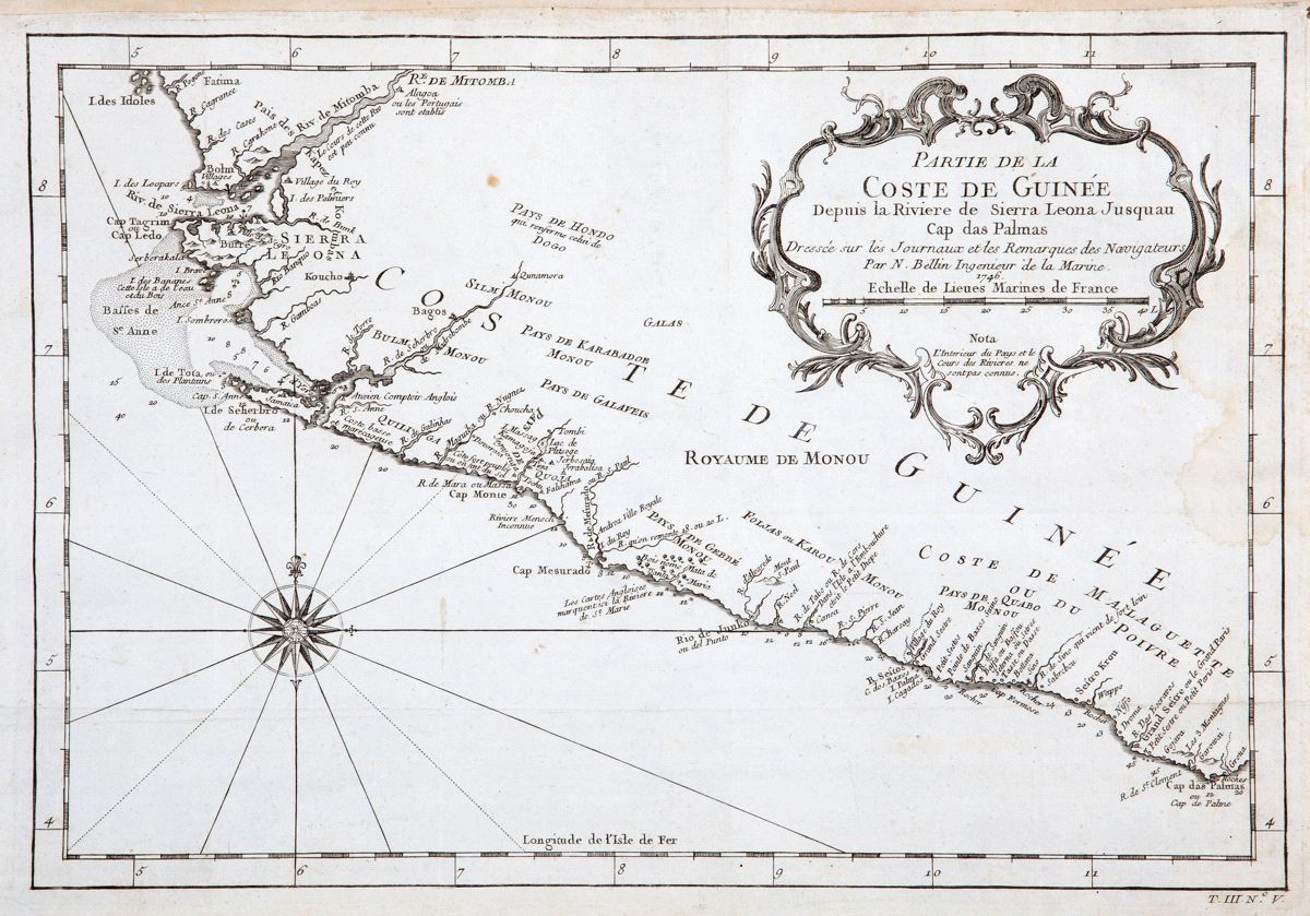
Partie de la Coste de Guinee Depuis la Riviere de Sierra Leona Jusquau Cap das Palmas
This item has been sold. Please check our homepage for currently available maps.
Bellin's beautifully detailed map of the Guinea coast in west Africa, from the Sierra Leone River to Cape Palmas on the southern coast of what is now Liberia, from the atlas of Prevost d'Exiles' influential collection of travel narratives, Histoire Generale des Voyages. Features many place names and a decorative title cartouche. Item Number: RS2325
Cartographer: Bellin
Place & Date: Paris / 1746/1760
Size: 13" x 9"
Condition: b&w light overall age toning; some spotting; a light water stain on the right margin, extending about an inch into the map; folded and margins extended with contemporary paper to fit the size of the atlas volume
Price: SOLD