
use +/- or mouse scrollwheel for magnification. click here for full-sized image.
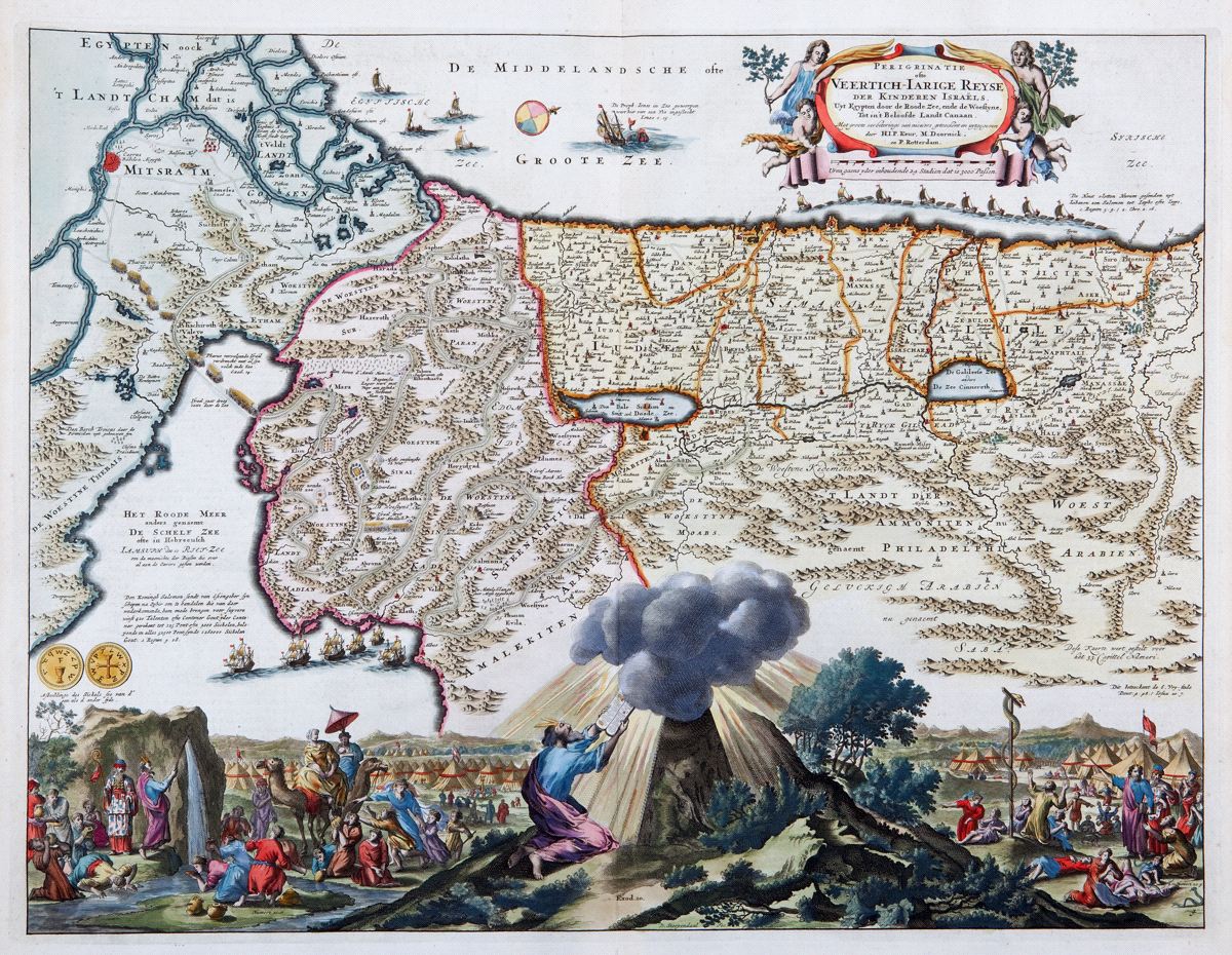
Peregrinatie ofte Veertich-Iarige Reyse der Kinderen Israels
This item has been sold. Please check our homepage for currently available maps.
A splendidly illustrated and beautifully colored map of the Holy Land, oriented with west at the top and extending from the Nile Delta to Sidon. The map shows the route taken by the Hebrews during their 40-year trek from Egypt to the Promised Land. In the Mediterranean, Jonah is shown struggling with the whale. Scenes from the Wandering in the Desert are illustrated at the bottom of the sheet, with Moses receiving the Ten Commandments at the center. Item Number: RS2302
Cartographer: Keur, Doornick, Rotterdam
Place & Date: Dordrecht / 1702
Size: 17 1/2" x 14"
Condition: light overall age-toning; some browning and staining in the margins
Price: SOLD