
use +/- or mouse scrollwheel for magnification. click here for full-sized image.
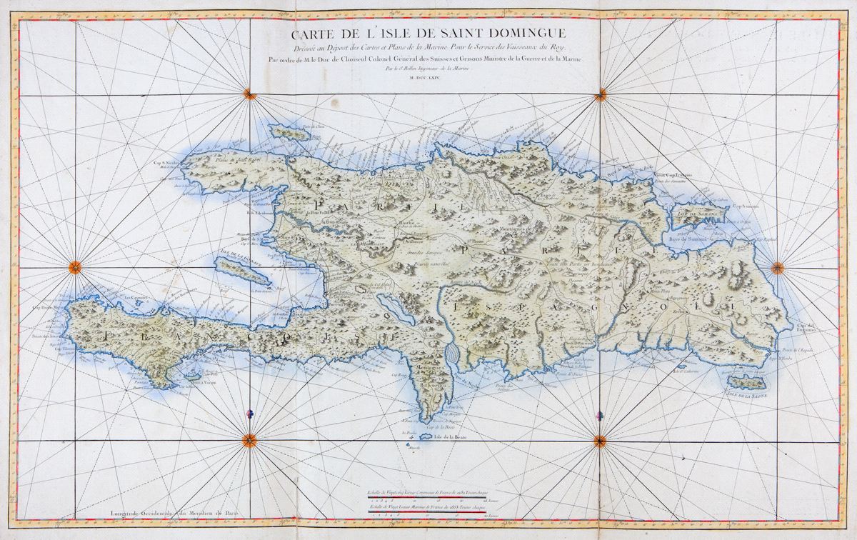
Carte de l'Isle de Saint Domingue.
This item has been sold. Please check our homepage for currently available maps.
The first edition of Bellin's spectacular, large scale map of Hispaniola. Its meticulous topographical and nautical detail makes this one of the major 18th century maps of Santo Domingo. Item Number: RS2264
Cartographer: Bellin
Place & Date: Paris / 1764
Size: 36 1/2" x 22 3/8"
Condition: wash color; overall age toning and some spotting, more concentrated in the margins; repaired splits and tear along folds; edge of left margin frayed
Price: SOLD