
use +/- or mouse scrollwheel for magnification. click here for full-sized image.
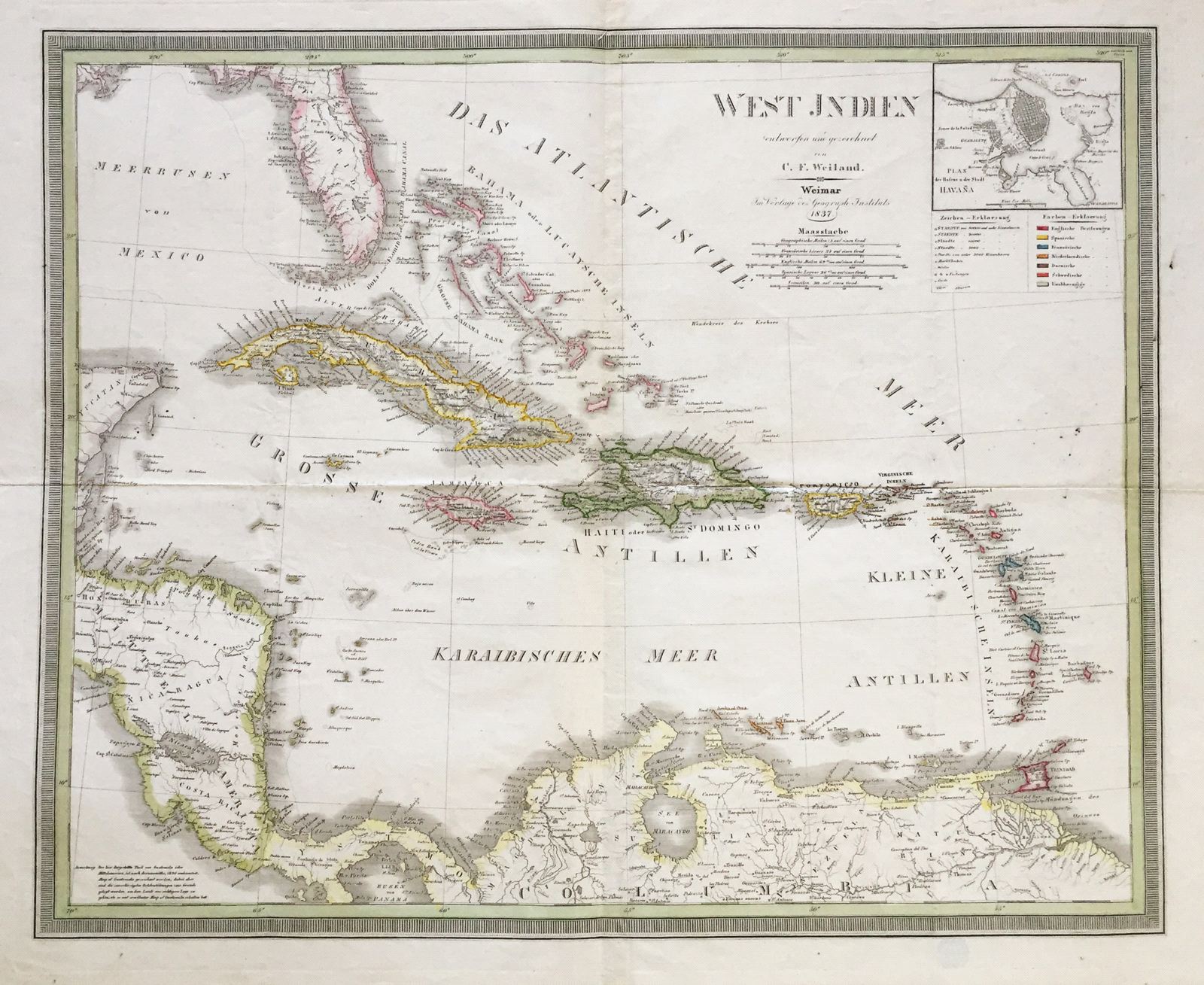
West Jndien
This item has been sold. Please check our homepage for currently available maps.
The 1830 edition of Weiland's large, highly detailed map of the West Indies, encompassing most of Florida, the Bahamas, part of Central America, and northern South America. Includes an inset plan of Havana, Cuba, and a color key to the region's European colonial powers. Item Number: RS2262
Cartographer: Weiland
Place & Date: Weimar / 1837
Size: 23 1/4" x 18 7/8"
Condition: outline color; overall age toning, some spotting and wrinkling, and light browning along the centerfold and margin edges
Price: SOLD