
use +/- or mouse scrollwheel for magnification. click here for full-sized image.
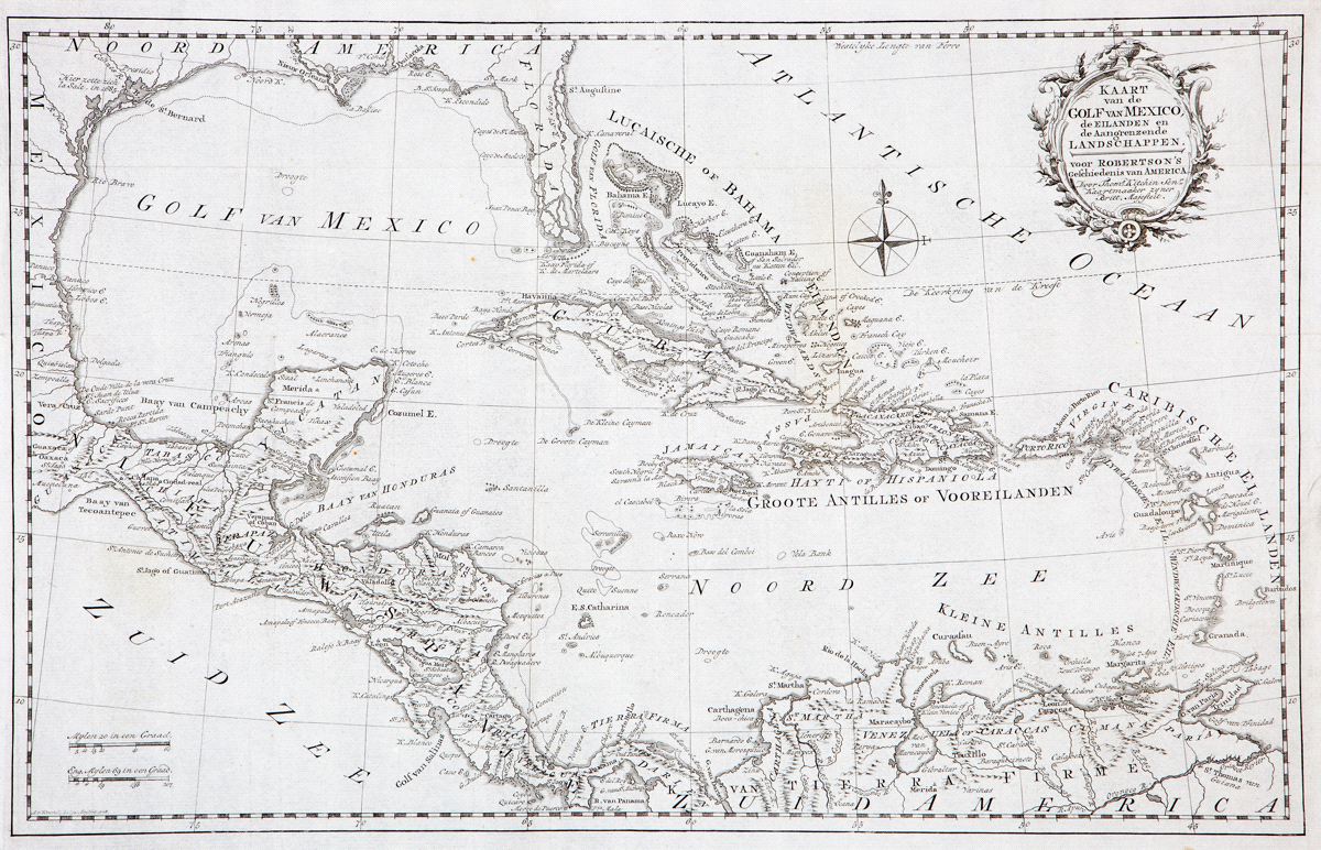
Kaart van de Golf van Mexico, de Eilanden en de Aangrenzende Landschappen
This item has been sold. Please check our homepage for currently available maps.
Kitchin's sweeping and well-detailed "Map of the Gulf of Mexico, the Islands and Countries Adjacent," from the Dutch edition of Robertson's History of America. Derived from an earlier, somewhat retrograde French map of the region by Robert Bérnard, Kitchin's map shows Florida as overly narrow, with a fragmented southern tip. Includes an ornate floral and scrollwork cartouche and a handsome compass rose to the right of the Bahamas.. Item Number: RS2252
Cartographer: Thomas Kitchin
Place & Date: Amsterdam / 1778
Size: 19 1/8" x 12 1/4"
Condition: b&w; a beautifully preserved exemplar, with folds as issued
Price: SOLD