
use +/- or mouse scrollwheel for magnification. click here for full-sized image.
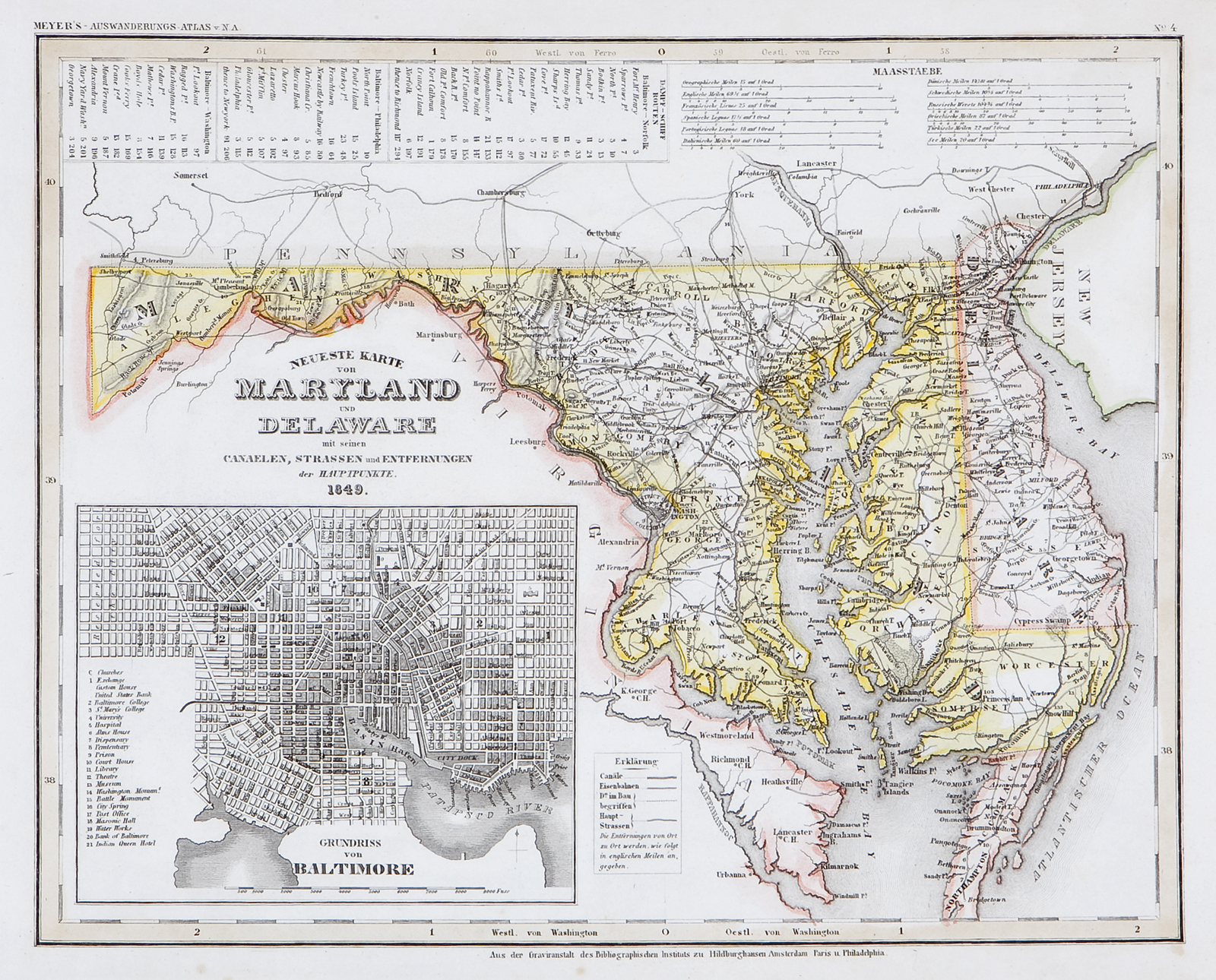
Neueste Karte von Maryland und Delaware 1849
This item has been sold. Please check our homepage for currently available maps.
A superbly detailed map of Maryland and Delaware, "with its canals, streets, and distances between main points," from Meyer's Auswanderungs-Atlas (Emigrant's Atlas) of North America. Includes a key to canals, railroads, and main roads; lists of routes and distances between Baltimore and Norfolk, Philadelphia and Washington; and a meticulous street plan of Baltimore with a numbered key to the major sites. Item Number: RS2197
Cartographer: Bibliographischen Instituts.
Place & Date: Hildburghausen / 1849/1857
Size: 14 5/8" x 11 3/4"
Condition: original outline color; light overall age toning, minor spotting mostly in margins
Price: SOLD