
use +/- or mouse scrollwheel for magnification. click here for full-sized image.
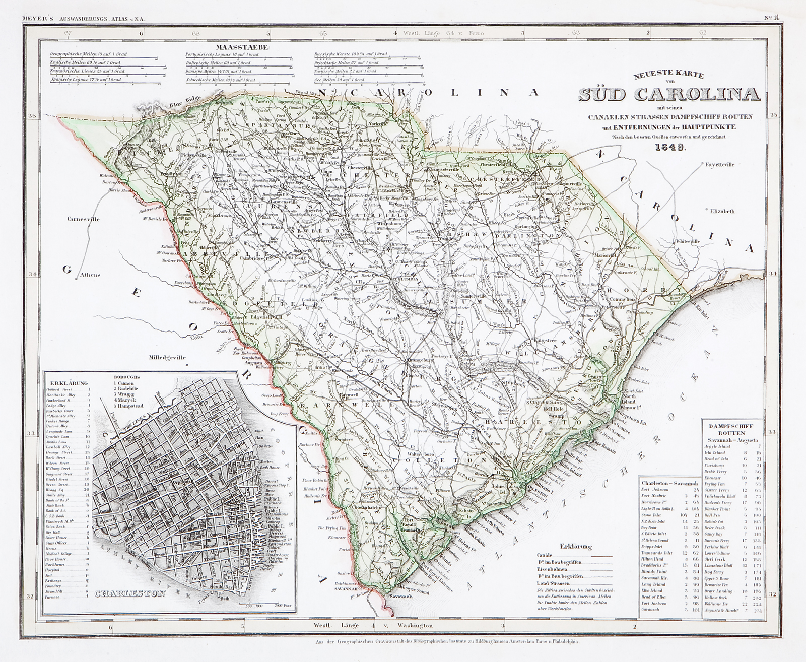
Neueste Karte von Sud Carolina
This item has been sold. Please check our homepage for currently available maps.
The beautifully detailed and colored map of South Carolina "with its canals, streets, steamship routes and distances between main towns" from Meyer's Auswanderungs-Atlas (Emigrant's Atlas) of North America. Includes a key to canals, railroads, and main roads, as well as steamship routes between Charleston and Savannah and Savannah and Augusta and an inset plan of Charleston. Item Number: RS2195
Cartographer: Bibliographisches Instituts. / Joseph Meyer
Place & Date: Hildburghausen / 1849/1857
Size: 14 5/8" x 11 3/4"
Condition: original color; minor spotting along bottom margin
Price: SOLD