
use +/- or mouse scrollwheel for magnification. click here for full-sized image.
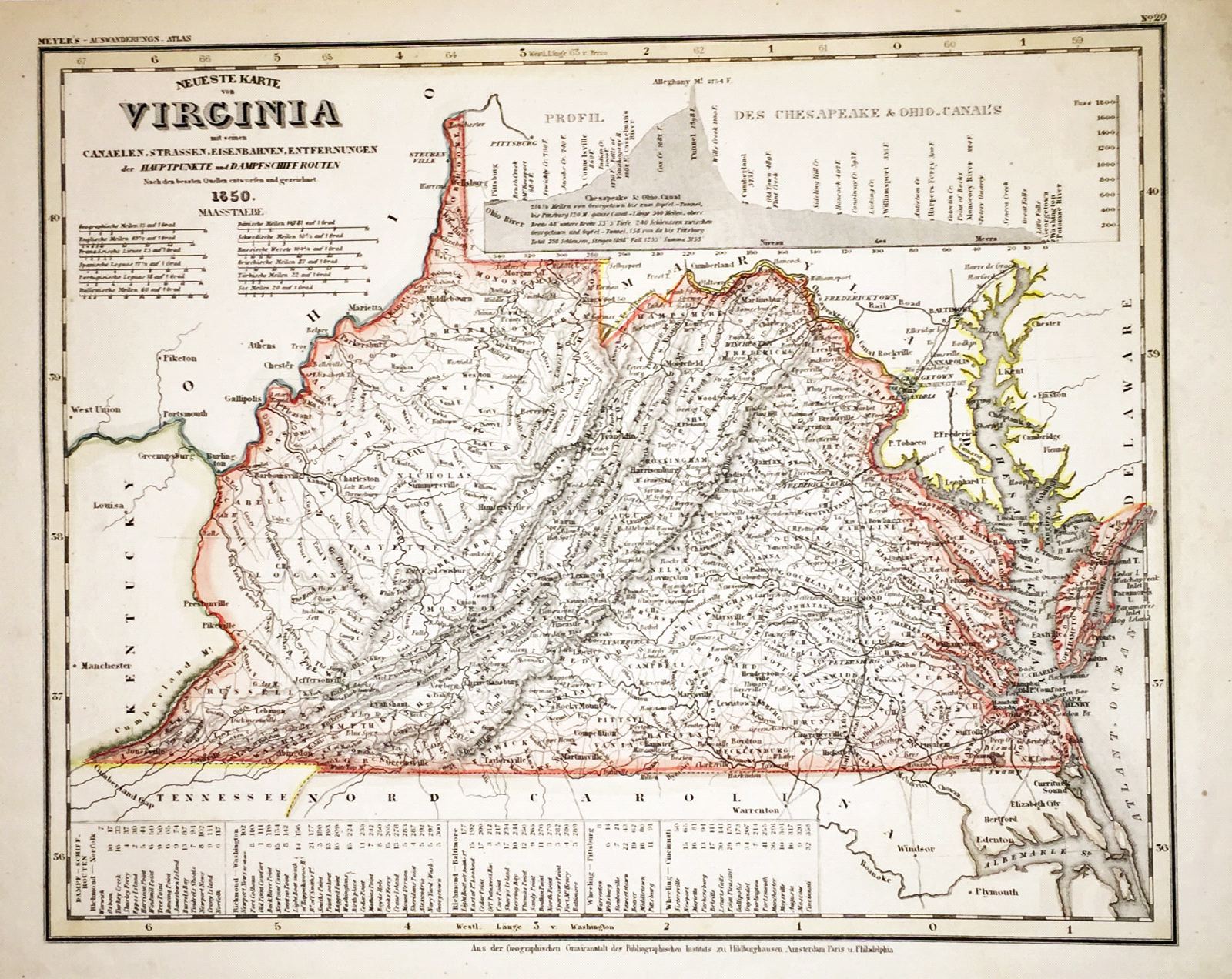
Neueste Karte von Virginia
This item has been sold. Please check our homepage for currently available maps.
A superbly detailed map of Virginia, "with its canals, streets, railroads, distances between main points, and steamship routes," from Meyer's Auswanderungs-Atlas (Emigrant's Atlas) of North America. Includes a "profile of Chesapeake and Ohio Canals" extensive lists of steamship routes and distances between Richmond and Norfolk, Washington and Norfolk and between Wheeling and Pittsburgh and Cincinnati. Item Number: RS2194
Cartographer: Bibliographischen Instituts.
Place & Date: Hildburghausen / 1849/1857
Size: 14 3/4" x 11 5/8"
Condition: original outline color; overall age toning, minor spotting and browning in margins
Price: SOLD