
use +/- or mouse scrollwheel for magnification. click here for full-sized image.
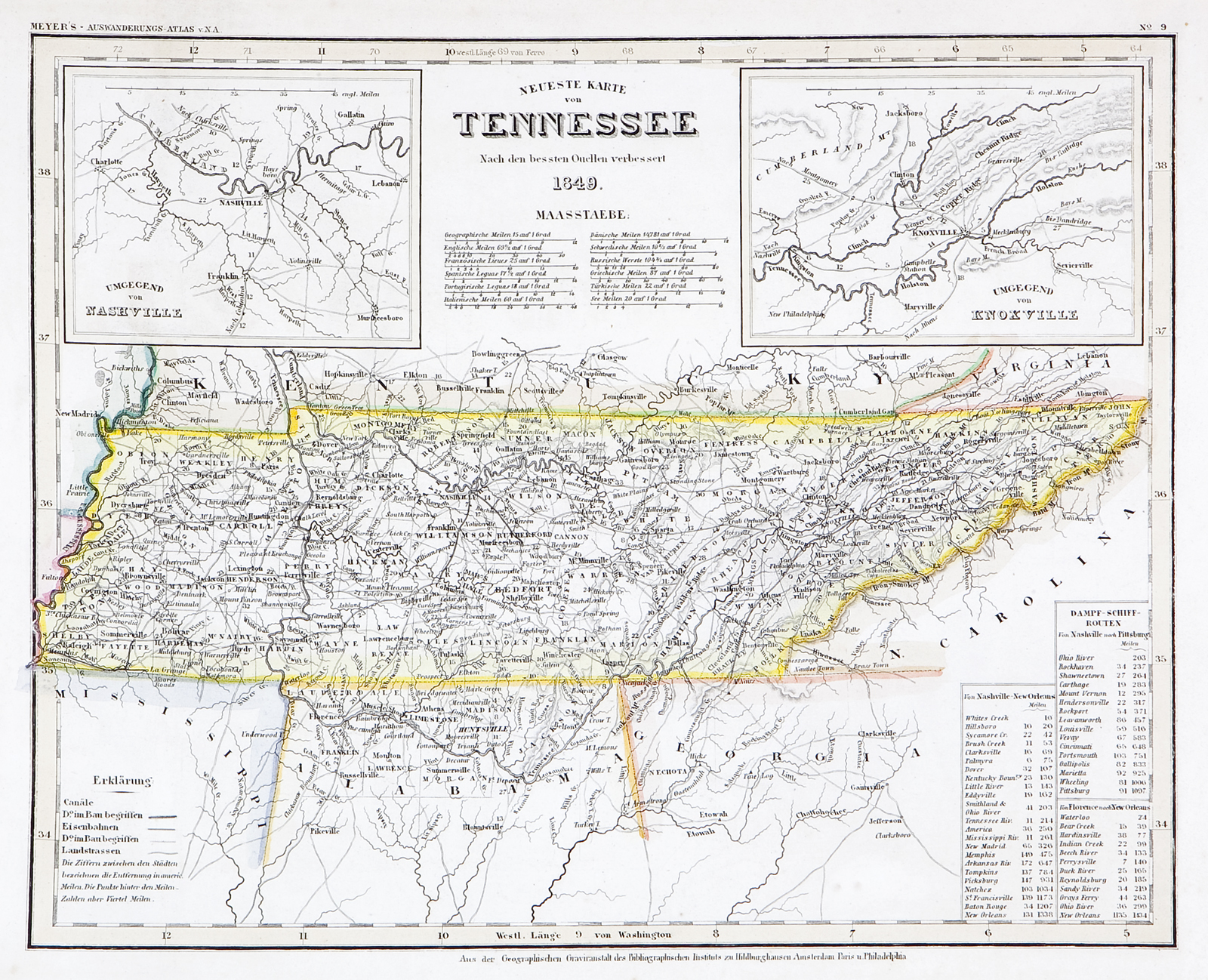
Neueste Karte von Tennessee 1849
This item has been sold. Please check our homepage for currently available maps.
The beautifully detailed and colored map of pre-Civil War Tennessee, from Meyer's Auswanderungs-Atlas (Emigrant's Atlas) of North America. Includes a key to canals, railroads, and main roads; steamship routes between Nashville and New Orleans and Nashville and Pittsburgh and inset maps of the Nashville region and of the Knoxville region. Item Number: RS2189
Cartographer: Joseph Meyer/Bibliographischen Instituts.
Place & Date: Hildburghausen / 1849/1857
Size: 14 5/8" x 11 3/4"
Condition: original outline color; light overall age toning
Price: SOLD