
use +/- or mouse scrollwheel for magnification. click here for full-sized image.
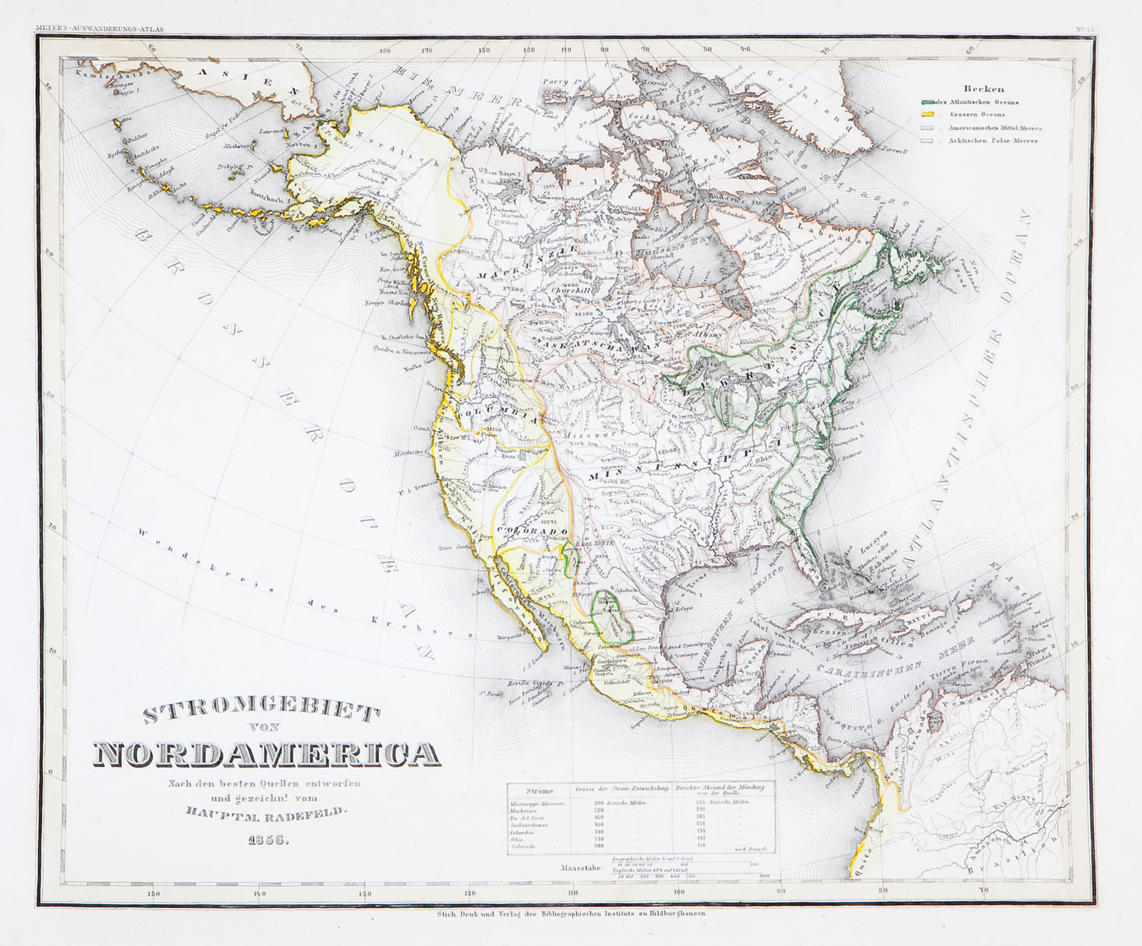
Stromgebiet von Nordamerica
This item has been sold. Please check our homepage for currently available maps.
A highly detailed and unusual map geological/hydrographical map of the United States from Meyer's Auswanderungs-Atlas (Emigrant's Atlas) of North America, showing the nation's various drainage systems (Stromgebiet means "river basins"). Each of the continent's main river systems is identified by color. Item Number: RS2166
Cartographer: Bibliographischen Instituts. / Radefeld
Place & Date: Hildburghausen / 1849/1857
Size: 14 1/4" x 11 3/8"
Condition: original outline color; a well preserved exemplar
Price: SOLD