
use +/- or mouse scrollwheel for magnification. click here for full-sized image.
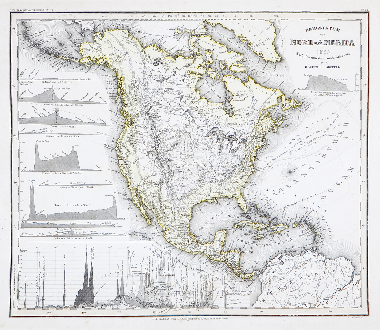
Bergsystem von Nord-America
This item has been sold. Please check our homepage for currently available maps.
The beautifully detailed and preserved map of the "mountains systems of North America" from Meyer's Auswanderungs-Atlas (Emigrant's Atlas) of North America. This map's topographical detail is especially fine in its description of the continent's river and mountain systems. Flanking the Pacific coast are profiles of mountains and plateaus of North and Central America and a chart of the continent's highest peaks. Item Number: RS2161
Cartographer: Bibliographischen Instituts. / Radefeld
Place & Date: Hildburghausen / 1849/1857
Size: 14" x 11 5/8"
Condition: original outline color; a well preserved exemplar
Price: SOLD