
use +/- or mouse scrollwheel for magnification. click here for full-sized image.
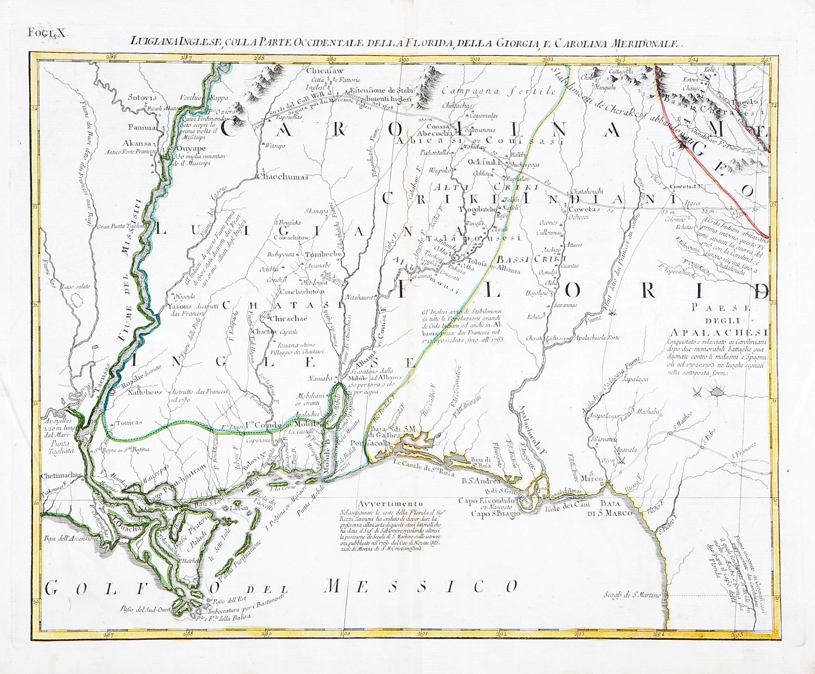
Luigiana Inglese, colla parte Occidentale, della Florida, della Georgia, e Carolina Merid[i]onale
This item has been sold. Please check our homepage for currently available maps.
The map of "English Louisiana and the western part of Florida, Georgia and South Carolina" from Zatta's 1778 12-sheet version of Mitchell's landmark map of North America. A superb and fascinating map of the northeastern Gulf Coast, rich in topographical detail and historical, geographical and ethnic notes. Item Number: RS2157
Cartographer: Zatta
Place & Date: Venice / 1778
Size: 16 1/2" x 12 1/2"
Condition: Original color; light overall age toning; two creases on side margins; nicks,fraying, and some waterstaining along edges of bottom margin
Price: SOLD