
use +/- or mouse scrollwheel for magnification. click here for full-sized image.
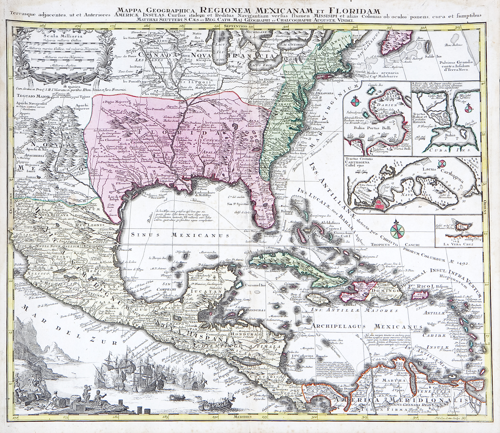
Mappa Geographica Regionem Mexicanam et Floridam Terrasque adjacentes.
This item has been sold. Please check our homepage for currently available maps.
Seutter's superb map of North America, including Central America and the West Indies. This highly detailed New World map shows the routes of the Spanish treasure fleets and includes inset plans of Porto Bello (Panama), Havana, and Cartagena; a magnificent vignette of battling ships and European traders; and a decorative floral and marine-motif mileage scale cartouche. Item Number: RS2125
Cartographer: Matthäus Seutter
Place & Date: Augsburg / 1730s
Size: 22 1/2" x 19 1/2"
Condition: original color; light overall age toning and light spotting and minor staining throughout
Price: SOLD