
use +/- or mouse scrollwheel for magnification. click here for full-sized image.
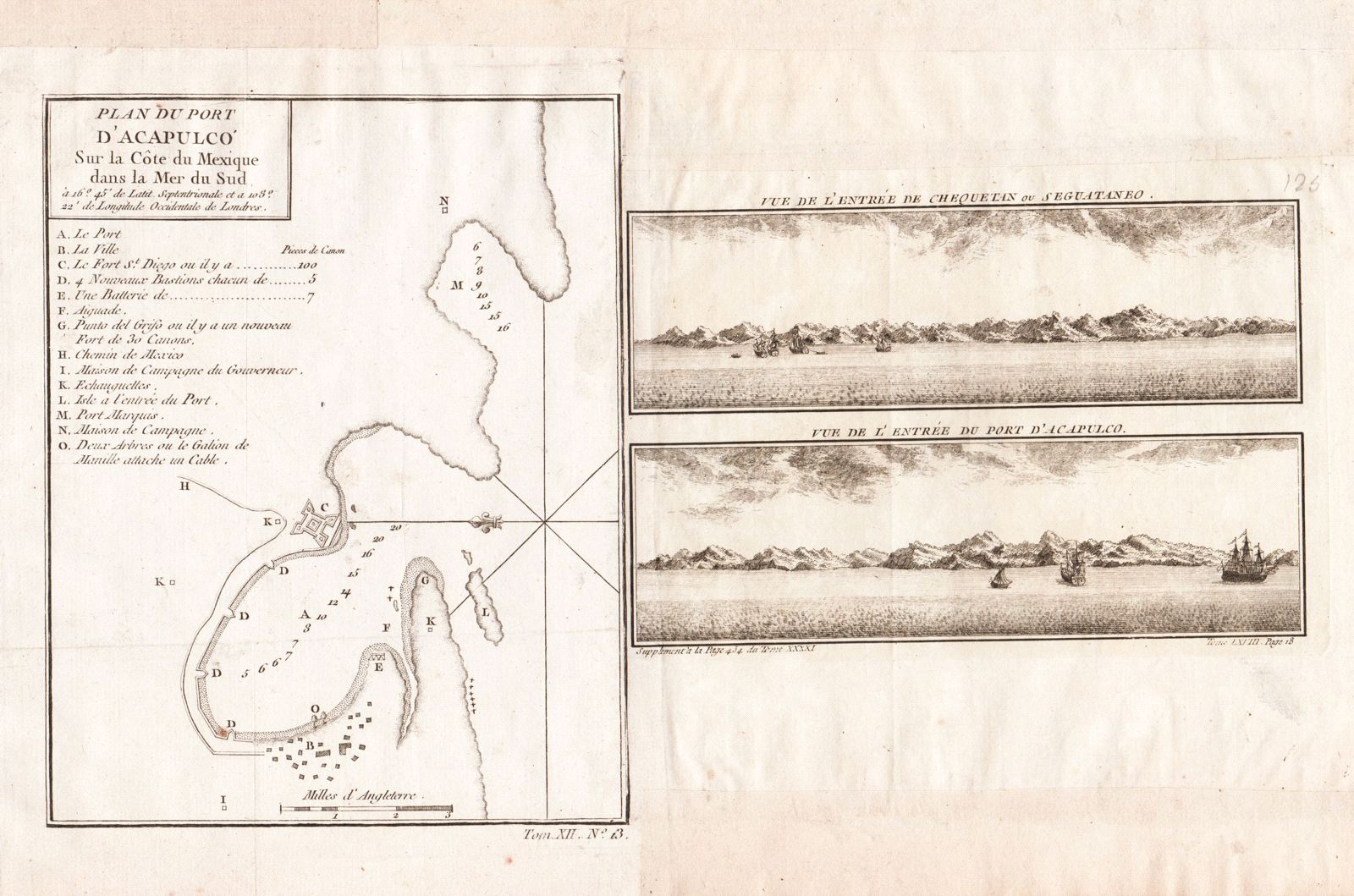
Plan du Port d'Acapulco [and on the same sheet] Vue de l'Entree de Chequetan ou Seguataneo/Vue de l'Entree du Port d'Acapulco
This item has been sold. Please check our homepage for currently available maps.
A plan and two views of sites in Mexico from the atlas of Prevost d'Exiles' influential collection of travel narratives, Histoire Generale des Voyages. On the left, is Bellin's detailed plan of the important Pacific port of Acapulco, with a letter key indicating the city, its fort, "the road to Mexico City," and other sites and features. On the right, are two beautifully engraved viewsof what are now Mexican tourist meccas: Chequetan or Seguataneo (Zihuatanejo), top, and Acapulco, bottom. Item Number: RS2065
Cartographer: Bellin
Place & Date: Paris / 1754/1760
Size: 5 7/8" x 7 1/2" (plan); 6 7/8" x 4 5/8" (combined views)
Condition: b&w; light overall age-toning and minor spotting; margins extended with contemporary paper to fit the size of the volume
Price: SOLD