
use +/- or mouse scrollwheel for magnification. click here for full-sized image.
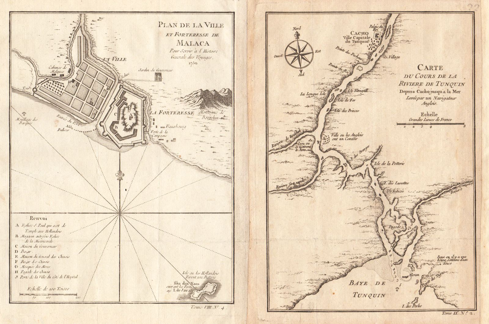
Plan de la Ville et Forteresse de Malaca [and on the same sheet] Carte du Cours de la Riviere de Tunquin [Tonkin] Depuis Cacho jusqu'a la Mer
This item has been sold. Please check our homepage for currently available maps.
Two scarce Southeast Asia maps on a single sheet from the atlas of Prevost d'Exiles' influential collection of travel narratives, Histoire Generale des Voyages. On the left is Bellin's meticulously detailed plan of the city and fort of Malacca on the southern Malay Peninsula, commanding the strategic straits of the same name. On the right is Bellin's beautifully engraved chart of the course of the Tonkin, or Red (Hong), River, which flows across northern Vietnam through Hanoi and Haiphong into the Gulf of Tonkin. Encompassing the territory between the royal capital of Cacho (today's Hanoi) to the Red River delta, this is a unusual and fascinating Vietnam item. Item Number: RS2049
Cartographer: Bellin
Place & Date: Paris / 1750/1760
Size: 6" x 7 7/8" (Malaca); 5 5/8" x 8 1/8"
Condition: b&w; overall age toning (darker on the Tunquin map); some minor spotting; margins extended with contemporary paper to fit the size of the atlas volume;
Price: SOLD