
use +/- or mouse scrollwheel for magnification. click here for full-sized image.
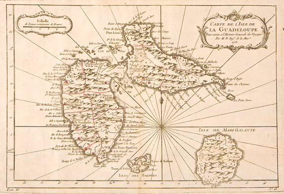
Carte de l'Isle de la Guadeloupe.
This item has been sold. Please check our homepage for currently available maps.
Bellin's elegant map of Guadeloupe and the adjacent islands of Les Sainte and Marie Galante, with excellent topographical details, many place names, radiating rhumb lines, and two rococo cartouches (title and mileage scale). From the atlas of Prevost's Histoire Generale des Voyages. Item Number: RS2044
Cartographer: Bellin
Place & Date: Paris / 1758/1760
Size: 12 1/2" x 8 3/4"
Condition: outline color; light overall age toning; light browning along centerfold; a tiny repaired puncture hole in the lower left quadrant; margins extended with contemporary paper to fit the size of the atlas volume
Price: SOLD