
use +/- or mouse scrollwheel for magnification. click here for full-sized image.
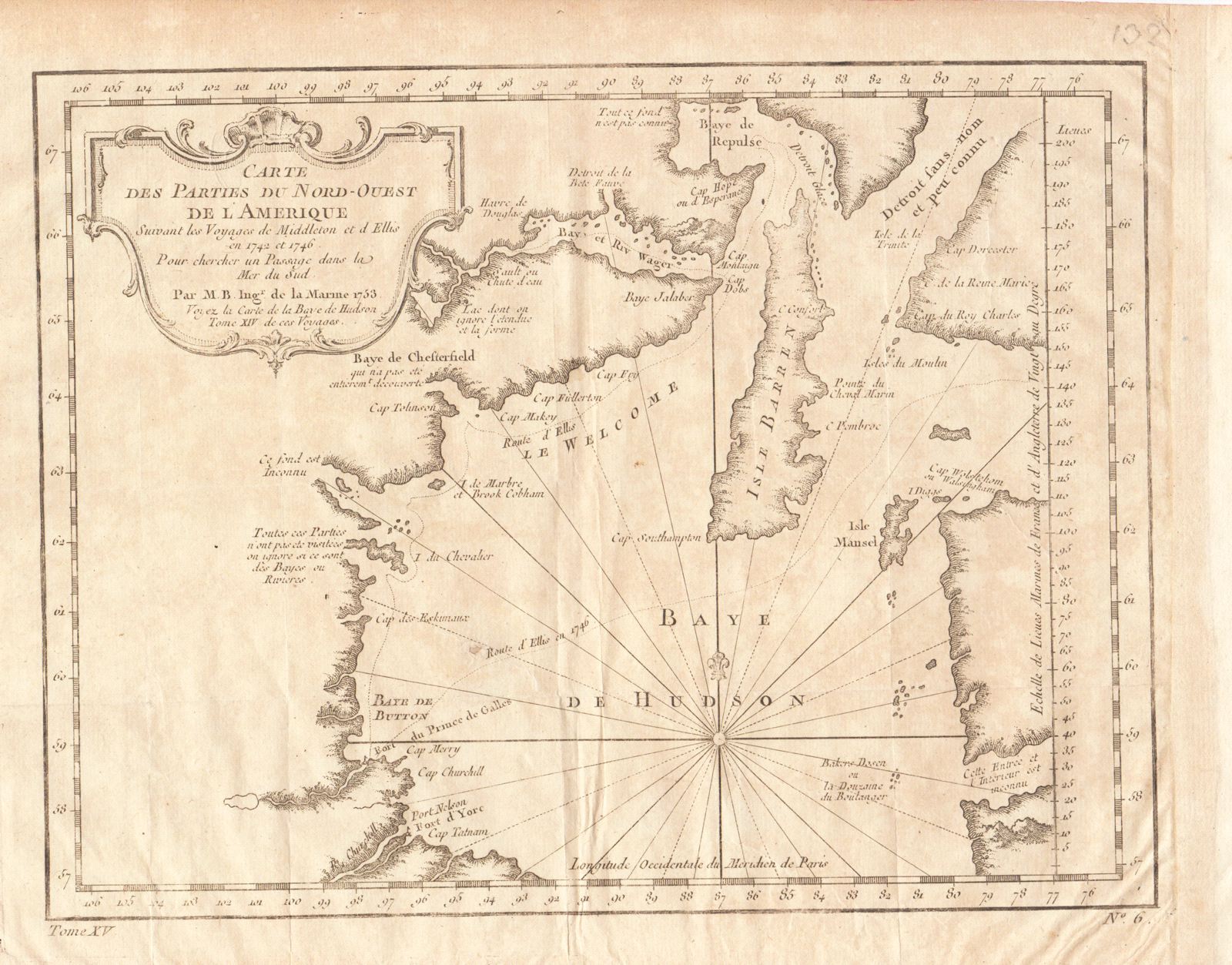
Carte des Parties du Nord-Ouest de l'Amerique
This item has been sold. Please check our homepage for currently available maps.
Bellin's map of the upper Hudson Bay showing the routes of Middleton and Ellis on their voyages in search of the elusive Northwest Passage to the Pacific in 1742 and 1746, from the atlas of Prevost d'Exiles' Histoire Generale des Voyages. Item Number: RS2036
Cartographer: Bellin
Place & Date: Paris / 1753/1760
Size: 10 3/4" x 8 1/8"
Condition: b&w; overall age toning; a small repaired puncture hole in the lower left quadrant; margins extended with contemporary paper to fit the size of the atlas volume
Price: SOLD