
use +/- or mouse scrollwheel for magnification. click here for full-sized image.
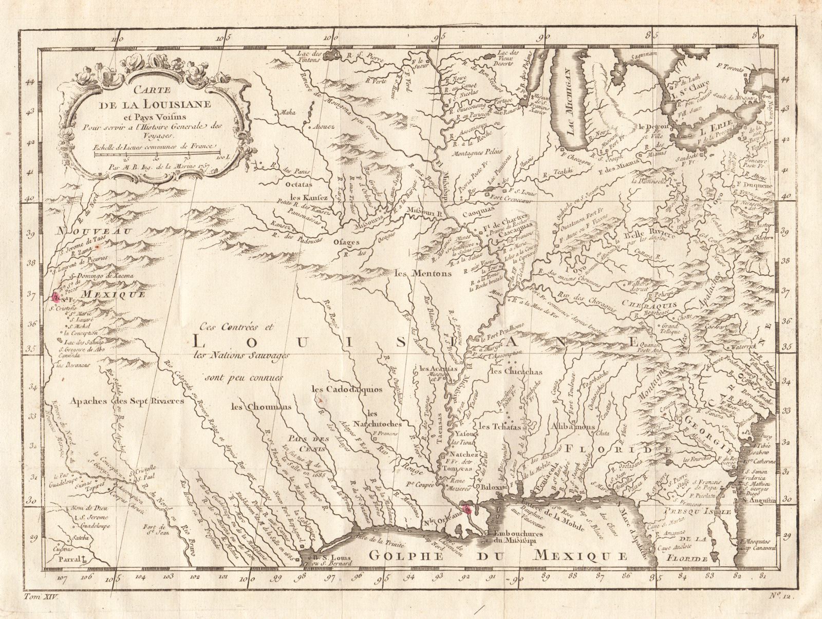
Carte de la Louisiane et Pays Voisins
This item has been sold. Please check our homepage for currently available maps.
Bellin's beautifully rendered and highly detailed map of Mississippi basin, extending from the eastern seaboard of North America to the Rio Grande and Santa Fe. Includes much topographical detail and the names of many Indian tribes, as well as a decorative title cartouche. From the atlas volume of Prevost d'Exiles' Histoire General des Voyages Item Number: RS2027
Cartographer: Bellin
Place & Date: Paris / 1757/1760
Size: 12" x 8 1/2"
Condition: b&w; light overall age toning; a tiny repaired puncture hole in the lower left quadrant; right margin extended with contemporary paper to fit the size of the atlas volume
Price: SOLD