
use +/- or mouse scrollwheel for magnification. click here for full-sized image.
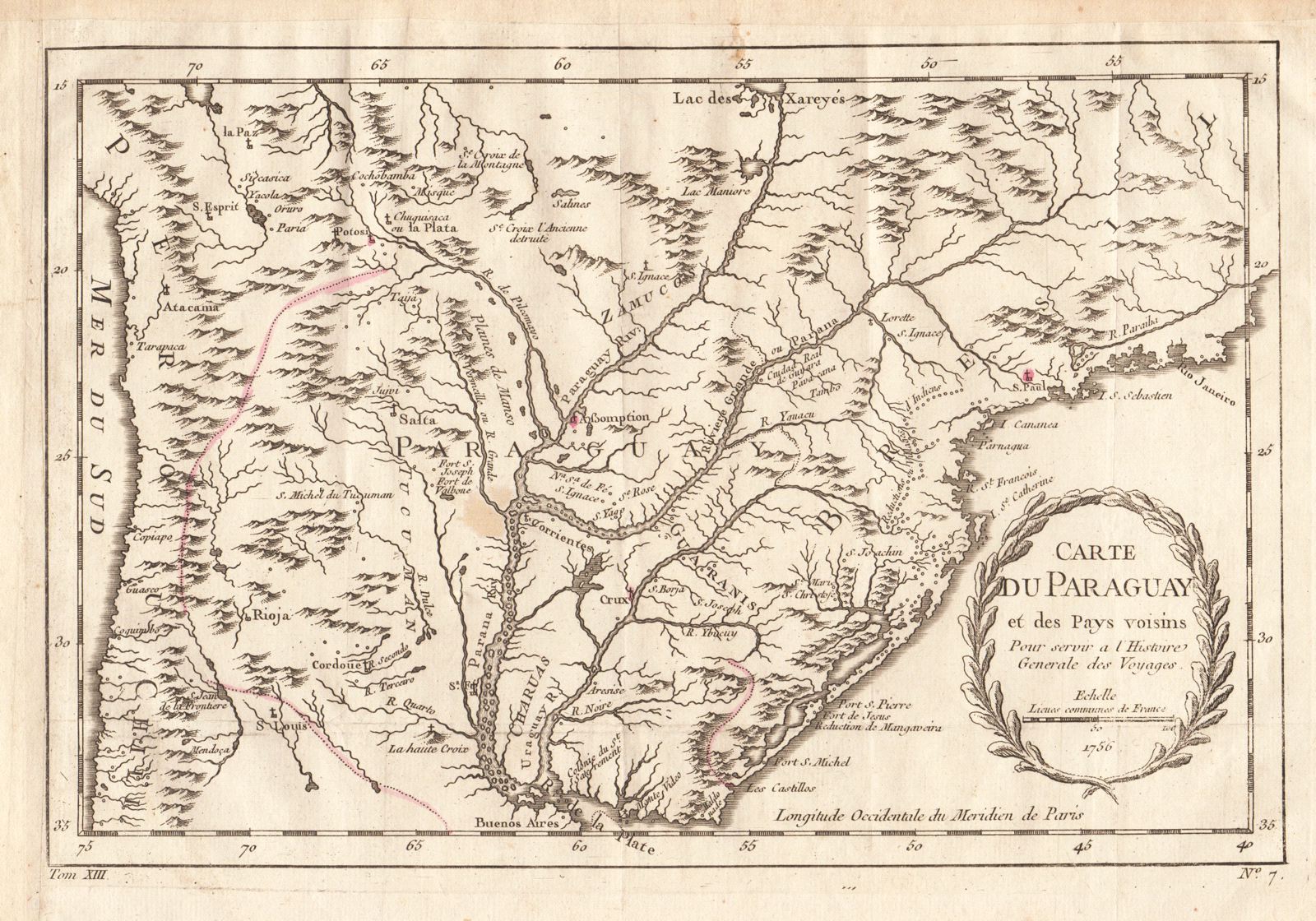
Carte du Paraguay et des Pays voisins
This item has been sold. Please check our homepage for currently available maps.
Bellin's highly detailed and superbly engraved map of the Parana River basin, encompassing modern-day Paraguay and Uruguay and parts of Argentina, Brazil, Chile, Peru, and Bolivia, from the atlas volume of Prevost d'Exiles' Histoire Generale des Voyages. Borders and the towns of Potosi, Bolivia; Asuncion and La Cruz, Paraguay, and Sao Paolo, Brazil, are highlighted in red. Item Number: RS2012
Cartographer: Bellin
Place & Date: Paris / 1756/1760
Size: 12 1/8" x 8 1/8"
Condition: b&w; a few light stains; margins extended with contemporary paper to fit the size of the atlas volume
Price: SOLD