
use +/- or mouse scrollwheel for magnification. click here for full-sized image.
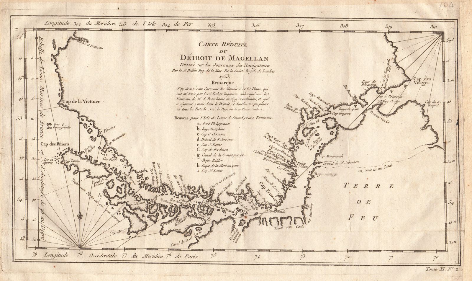
Carte Reduite du Detroit de Magellan
This item has been sold. Please check our homepage for currently available maps.
Bellin's superbly detailed map of the most important natural passage between the Atlantic and Pacific Oceans, the Straits of Magellan, from the atlas of Prevost d'Exiles' influential travel book, Histoire Generale des Voyages. Based on the "journals of navigators," the map includes excellent coastal detail, many place names, and a letter key to important topographical features. Item Number: RS2010
Cartographer: Bellin
Place & Date: Paris / 1753/1760
Size: 13 1/2" x 9"
Condition: b&w; old fold; margins extended with contemporary paper to fit the size of the atlas volume
Price: SOLD