
use +/- or mouse scrollwheel for magnification. click here for full-sized image.
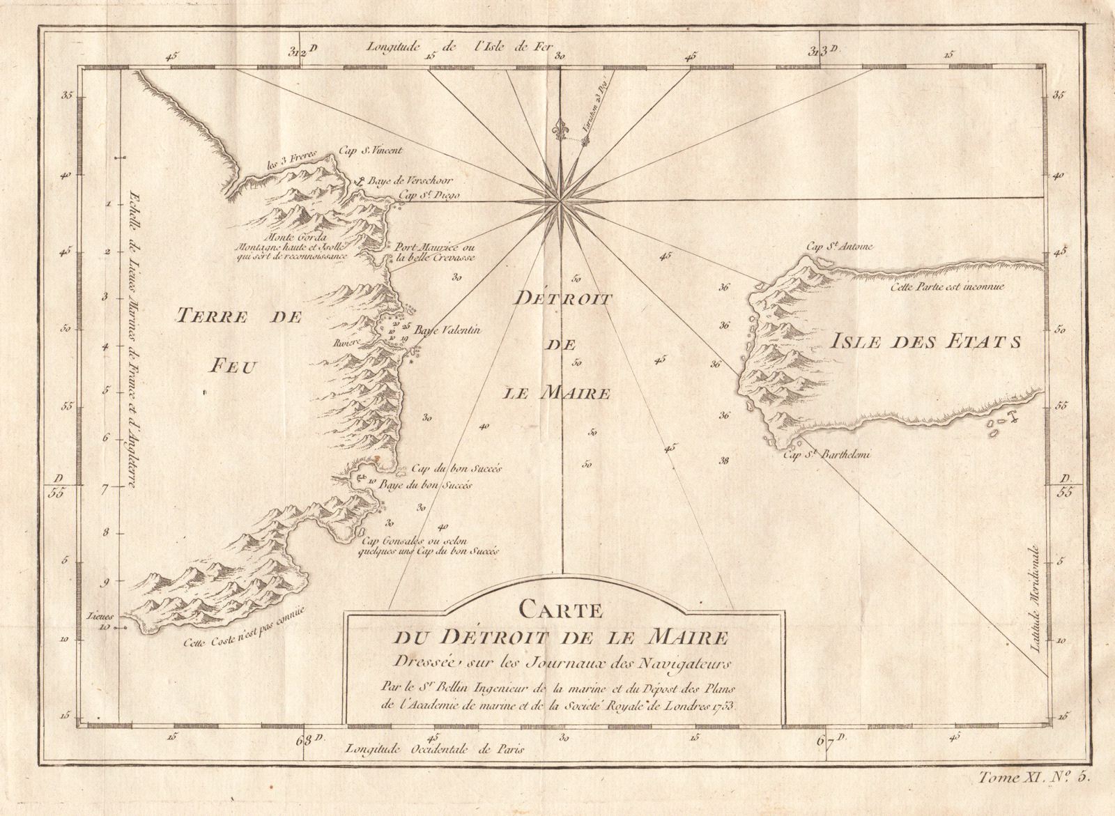
Carte du Detroit de le Maire
This item has been sold. Please check our homepage for currently available maps.
Bellin's beautifully rendered map of a key passage between the Atlantic and Pacific Oceans, the Le Maire Strait between Tierra del Fuego and Staten Island. The chart includes good coastal details, multiple depth soundings, and a dramatic compass rose. From the atlas of Prevost d'Exiles' influential travel book, Histoire Generale des Voyages. Item Number: RS2009
Cartographer: Bellin
Place & Date: Paris / 1753/1760
Size: 10 7/8" x 7 5/8"
Condition: b&w; light overall age toning; margins extended with contemporary paper to fit the size of the atlas volume
Price: SOLD