
use +/- or mouse scrollwheel for magnification. click here for full-sized image.
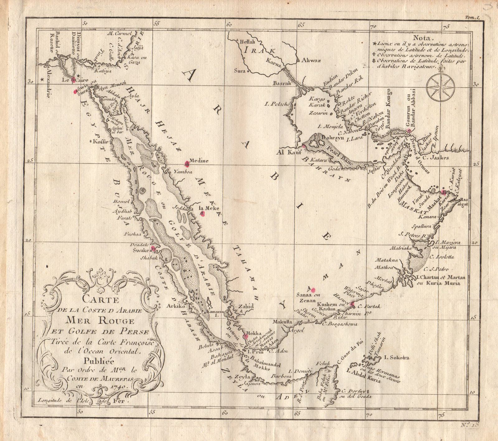
Carte de la Coste d'Arabie, Mer Rouge et Golfe de Perse
This item has been sold. Please check our homepage for currently available maps.
Bellin's highly detailed map of the "coast of Arabia, the Red Sea and the Persian Gulf," including eastern Egypt, the Arabian Peninsula, greater Syria (encompassing modern-day Israel and the Gaza Strip), "Irak," and Persia. From Prevost d'Exiles' influential collection of travel narratives, Histoire Generale des Voyages. Item Number: RS1981
Cartographer: Bellin
Place & Date: Paris / 1740/1760
Size: 9 7/8" x 8 5/8"
Condition: b&w; light overall age toning; margins extended with contemporary paper to fit the size of the atlas volume
Price: SOLD