
use +/- or mouse scrollwheel for magnification. click here for full-sized image.
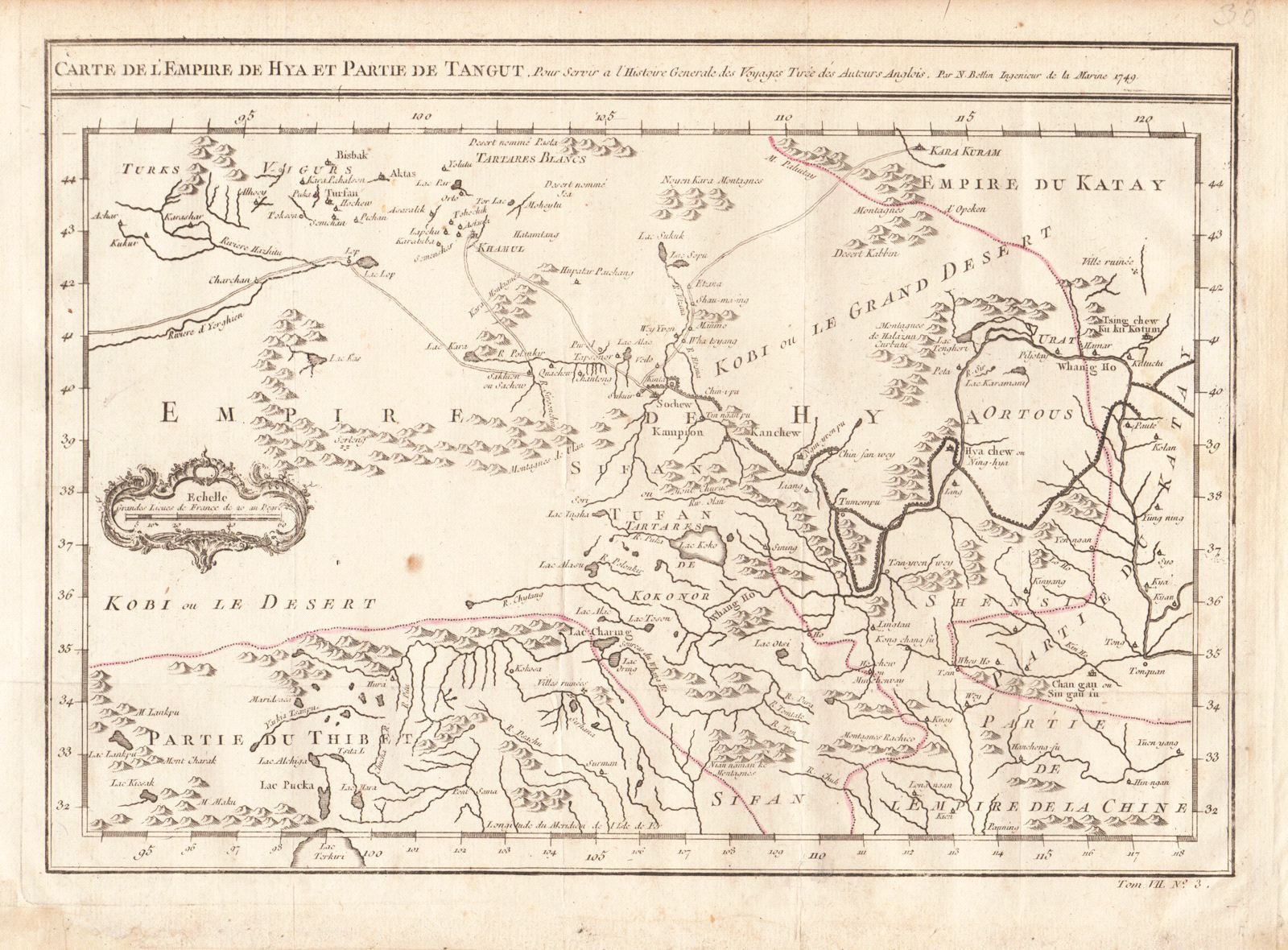
Carte de l'Empire de Hya et Partie de Tangut
This item has been sold. Please check our homepage for currently available maps.
Bellin's highly detailed map of Tartary and the Gobi Desert, encompassing part of Tibet and what is now China's Xinjiang Uyghur Autonomous Regiont, from Prevost d'Exiles' influential collection of travel narratives, Histoire Generale des Voyages. The map highlights the Silk Road to Karakorum and the Great Wall of China. Item Number: RS1975
Cartographer: Bellin
Place & Date: Paris / 1749/1760
Size: 12 1/8" x 8 5/8"
Condition: outline color; overall age toning, some minor spotting, and a light water stain on the right margin and edge of the map; margins extended with contemporary paper to fit the size of the atlas volume
Price: SOLD