
use +/- or mouse scrollwheel for magnification. click here for full-sized image.
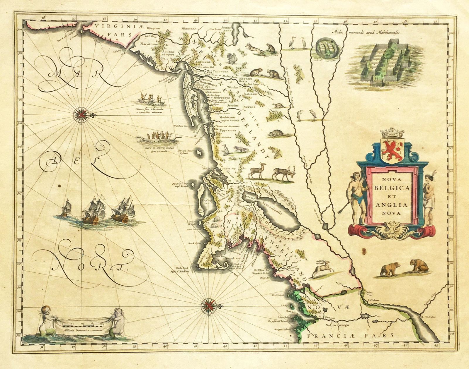
Nova Belgica et Anglia Nova
This item has been sold. Please check our homepage for currently available maps.
Blaeu's important, highly attractive and increasingly scarce map of New England and New Netherlands (New York), based on Adrian Block's 1614 manuscript map of the region. One of the first maps to show Manhattan as an island and to name New Amsterdam, Blaeu's Nova Belgica features decorative script; vignettes of European ships, native canoes, and local wildlife; a view of a Mohawk Indian village; and an elegant title cartouche. Item Number: RS1954
Cartographer: Blaeu
Place & Date: Amsterdam / 1640s
Size: 19 3/4" x 15 1/4"
Condition: Original color; overall browning; some repaired marginal tears and nicks and fraying along edges of margins
Price: SOLD