
use +/- or mouse scrollwheel for magnification. click here for full-sized image.
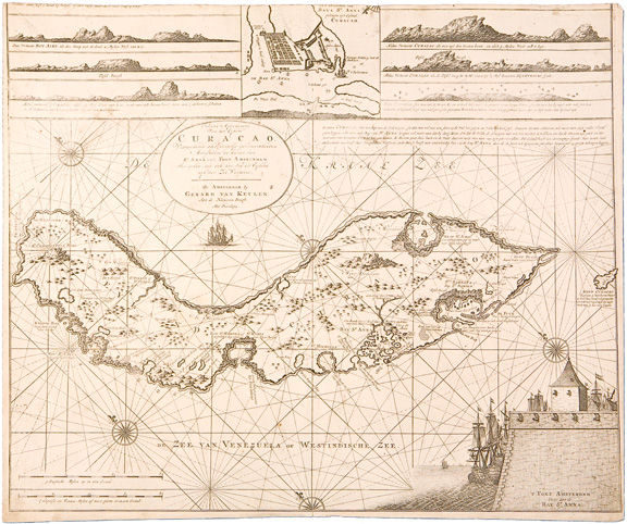
Nieuwe Afteekening van het Eyland Curacao
This item has been sold. Please check our homepage for currently available maps.
A superbly detailed and very scarce seachart of the island of Curacao, with multiple rhumb lines and compass roses, an inset of Bay St. Anna and coastal profiles at the top, and a beautiful illustration showing ships at anchor around Fort Amsterdam in Bay St. Anna at the lower right corner. Item Number: RS1949
Cartographer: van Keulen
Place & Date: Amsterdam / 1751
Size: 23" x 20"
Condition: b&w; light overall age toning and some spotting and staining; tiny hole at right center; trimmed with some loss of text at upper margin
Price: SOLD