
use +/- or mouse scrollwheel for magnification. click here for full-sized image.
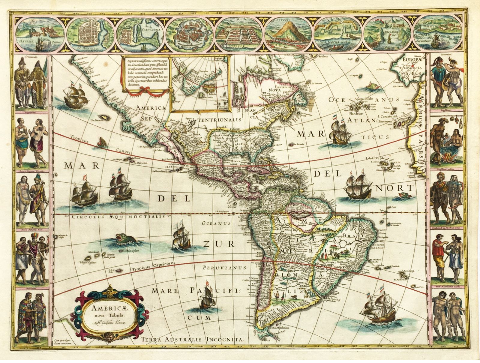
Americae nova Tabula
This item has been sold. Please check our homepage for currently available maps.
The third state of Blaeu's magnificent map of the Americas, this is a landmark document that summarizes "the general European view of the western hemisphere in the early 17th century." A classic golden-age "carte-a-figures," the map includes an inset of Greenland and is surrounded by nine New World city plans along the top and ten vignettes of New World natives along either side. From the Atlantis Appendix of 1630, this is one of the great expressions of the cartographer's art, in a superb exemplar. Item Number: RS1901
Cartographer: Willem Blaeu
Place & Date: Amsterdam / 1630
Size: 21 1/2" x 16 1/2"
Condition: some light spotting mostly confined to the margins and minor nicks along margin edges, otherwise a beautifully colored and preserved exemplar
Price: SOLD