
use +/- or mouse scrollwheel for magnification. click here for full-sized image.
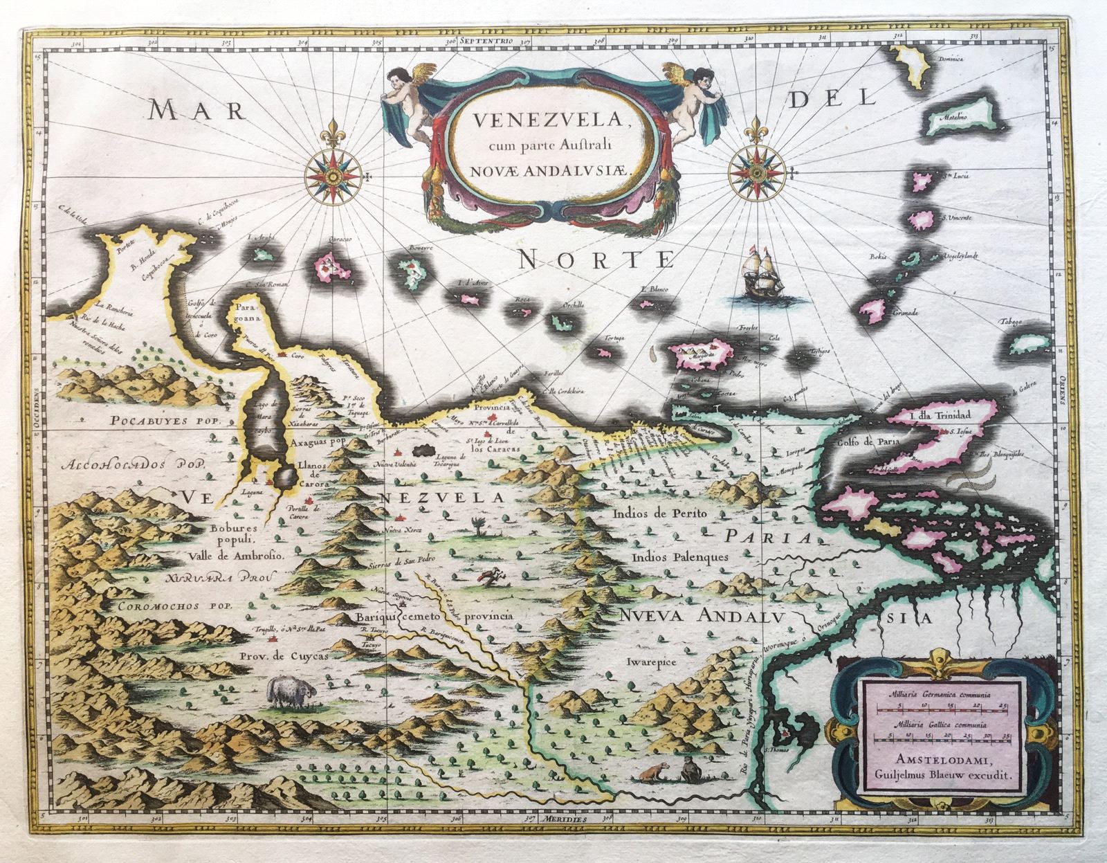
Venezuela cum parte Australe Novae Andalusiae.
This item has been sold. Please check our homepage for currently available maps.
Blaeu's dramatic Venezuela map extends from Rio de la Hacha to Trinidad and the mouth of the Orinoco and includes the Lesser Antilles up to Dominica. The interior shows good topographical details, many place names and Indian tribes, as well as charming vignettes of sheep, birds, and monkey-like creatures. Two decorative cartouches, compass roses, and sailing ships adorn this beautifully preserved and colored exemplar of an important South America map. Item Number: RS1894
Cartographer: Willem Blaeu
Place & Date: Amsterdam / 1638
Size: 19" x 15"
Condition: light overall age toning and minor spotting mostly along edge of bottom margin; a light water stain on the edge of the upper left margin; a tiny hole in the centerfold at the very bottom of the map
Price: SOLD