
use +/- or mouse scrollwheel for magnification. click here for full-sized image.
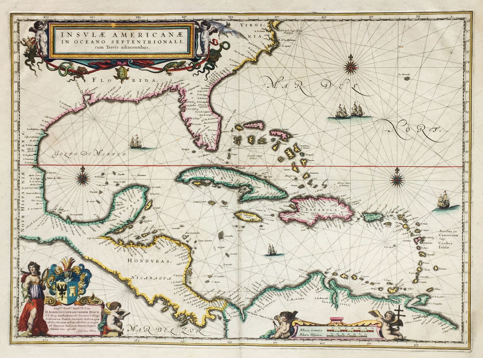
Insulae Americanae in Oceano Septentrionali.
This item has been sold. Please check our homepage for currently available maps.
One of the most beautiful maps of the Dutch Golden Age of cartography, Blaeu's chart of the Caribbean basin extends north to Virginia and the Chesapeake and south to the northern coast of South America. Rhumb lines, sailing ships, superb calligraphy, a mileage chart with cherubs, a wonderful title cartouche featuring snakes, bats, lizards and other New World fauna, and a sumptuous dedication cartouche featuring mythological figures and a coat of arms make this one of the most desirable of West Indies maps. Item Number: RS1893
Cartographer: Willem Blaeu
Place & Date: Amsterdam / 1635
Size: 21" x 15"
Condition: A beautifully colored exemplar; some age toning and a few spots mostly in margins; repaired split in upper margin centerfold
Price: SOLD