
use +/- or mouse scrollwheel for magnification. click here for full-sized image.
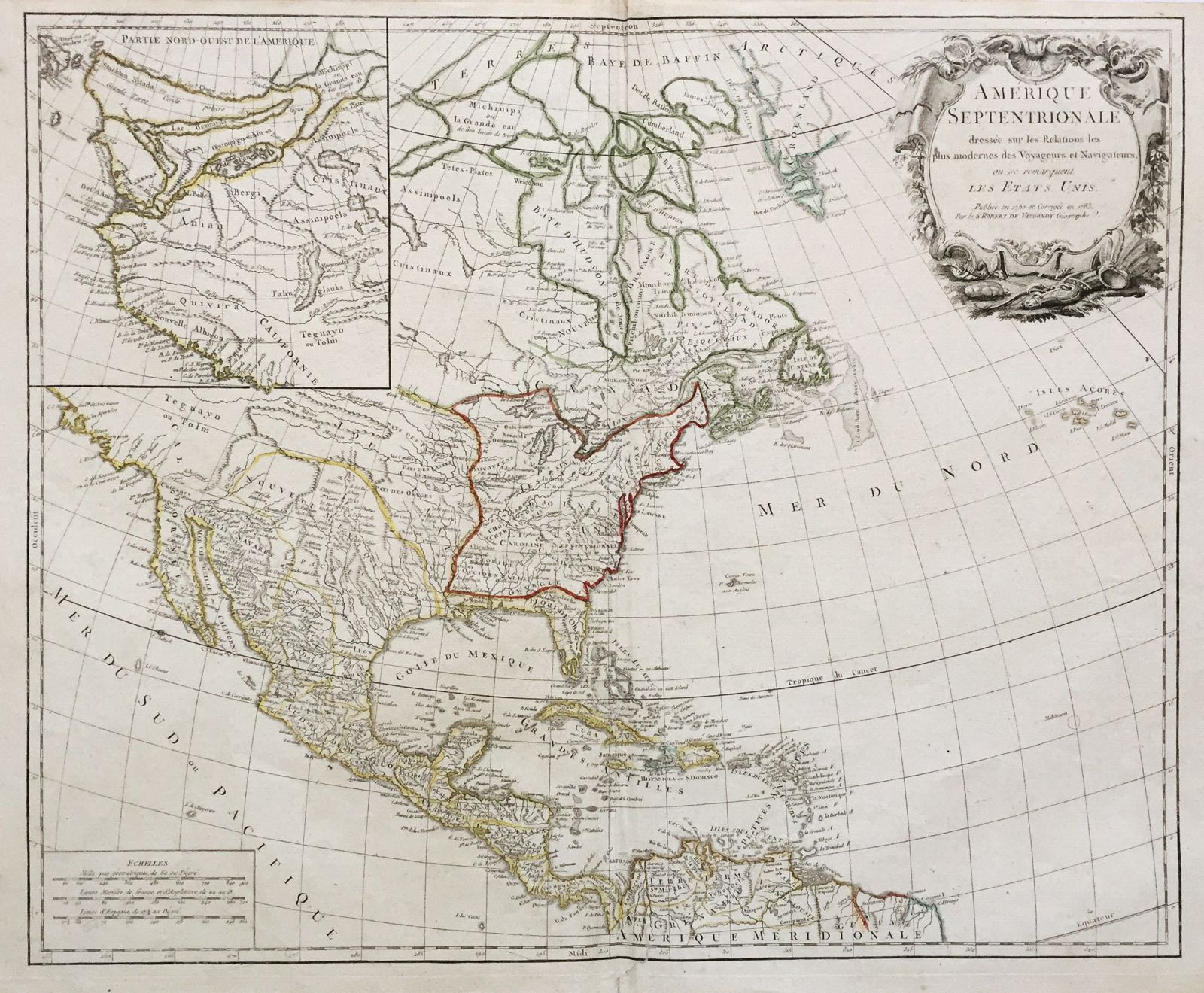
Amerique Septentrionale Dressee sur les Relations les Plus Modernes des Voyageurs et Navigateurs, ou se Remarquent les Etats Unis
This item has been sold. Please check our homepage for currently available maps.
de Vaugondy's important 1783 revision of his 1750 North America map shows the borders of the newly created United States and includes a new inset map of the slowly emerging northwestern quadrant of the continent. Item Number: RS1540
Cartographer: Robert de Vaugondy
Place & Date: Paris / 1750/1783
Size: 23" x 19"
Condition: outline color; light overall age-toning; minor spotting mostly in the margins; lower right edge of bottom margin browned and frayed; some wrinkling along centerfold; a well-repaired tear in the bottom margin at the centerfold extending into the border.
Price: SOLD